Sverkmoen
| Sverkmoen | |
|---|---|
| Farm area | |
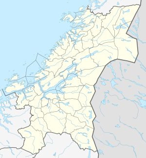
 Sverkmoen Location of the village  Sverkmoen Sverkmoen (Norway) | |
| Coordinates: 64°13′33″N 11°04′46″E / 64.2257°N 11.0795°ECoordinates: 64°13′33″N 11°04′46″E / 64.2257°N 11.0795°E | |
| Country | Norway |
| Region | Central Norway |
| County | Trøndelag |
| District | Namdalen |
| Municipality | Namdalseid |
| Elevation[1] | 134 m (440 ft) |
| Time zone | UTC+01:00 (CET) |
| • Summer (DST) | UTC+02:00 (CEST) |
| Post Code | 7750 Namdalseid |
Sverkmoen is a farm area in the municipality of Namdalseid in Trøndelag county, Norway. It is located west of the village of Namdalseid, between the lake Øyungen and the river Sverka which flows through a flat landscape area covered with forests (Norwegian: mo).
References
- ↑ "Sverkmoen, Namdalseid (Trøndelag)". yr.no. Retrieved 2018-04-15.
This article is issued from
Wikipedia.
The text is licensed under Creative Commons - Attribution - Sharealike.
Additional terms may apply for the media files.