Suttontown, North Carolina
| Suttontown, North Carolina | |
|---|---|
| Unincorporated community | |
 Location of Suttontown in North Carolina  Suttontown, North Carolina (the US) | |
| Coordinates: 35°12′13″N 78°14′26″W / 35.20361°N 78.24056°WCoordinates: 35°12′13″N 78°14′26″W / 35.20361°N 78.24056°W | |
| Country | United States |
| State | North Carolina |
| County | Sampson |
| Elevation[1] | 171 ft (52 m) |
| Time zone | UTC-5 (Eastern (EST)) |
| • Summer (DST) | UTC-4 (EDT) |
| ZIP code | 28341 |
| Area code(s) | 910 |
| GNIS feature ID | 995733[1] |
Suttontown is an unincorporated community in Sampson County, North Carolina, United States.
The Marshall Kornegay House and Cemetery was added to the National Register of Historic Places in 1986.[2]
References
Municipalities and communities of Sampson County, North Carolina, United States | ||
|---|---|---|
| City | 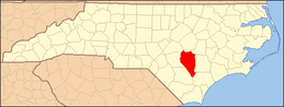 | |
| Towns | ||
| CDPs | ||
| Unincorporated communities | ||
| Footnotes | ‡This populated place also has portions in an adjacent county or counties | |
This article is issued from
Wikipedia.
The text is licensed under Creative Commons - Attribution - Sharealike.
Additional terms may apply for the media files.