Sutton, West Sussex
| Sutton | |
|---|---|
 | |
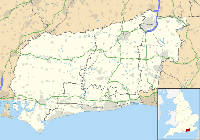 Sutton Sutton shown within West Sussex | |
| Area | 9.20 km2 (3.55 sq mi) [1] |
| Population | 425. 2011 Census[2] |
| • Density | 21/km2 (54/sq mi) |
| OS grid reference | SU979151 |
| • London | 45 miles (72 km) NNE |
| Civil parish |
|
| District | |
| Shire county | |
| Region | |
| Country | England |
| Sovereign state | United Kingdom |
| Post town | PULBOROUGH |
| Postcode district | RH20 |
| Dialling code | 01798 |
| Police | Sussex |
| Fire | West Sussex |
| Ambulance | South East Coast |
| EU Parliament | South East England |
| UK Parliament | |
Sutton is a village and civil parish in the District of Chichester in West Sussex, England, located six kilometres (4 miles) south of Petworth and east of the A285 road. The parish has a land area of 920 hectares (2272 acres). In the 2001 census 192 people lived in 83 households, of whom 83 were economically active.[1] The 2011 Census population included the village of Barlavington and hamlet of Codmore Hill.
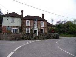
The village has an Anglican church, St John the Baptist, and one pub, the White Horse.
Landmarks
Coates Castle is a Site of Special Scientific Interest within the parish which at one time contained the entire known remaining British population of the field cricket Gryllus campestris.[3][4] The National Trust castle is within the neighbouring parish of Fittleworth.
Notable People
- Sir Gerald Barry a British newspaper editor and organiser of the Festival of Britain, lived at Forge House,[5] which was remodelled for him by F. R. S. Yorke in 1937.[6]
References
- 1 2 "2001 Census: West Sussex – Population by Parish" (PDF). West Sussex County Council. Archived from the original (PDF) on 8 June 2011. Retrieved 22 May 2009.
- ↑ "Civil Parish population 2011". Retrieved 14 October 2015.
- ↑ "SSSI Citation — Coates Castle" (PDF). Natural England. Retrieved 4 April 2009.
- ↑ "Endangered cricket reintroduced in South East England". Wildlife Extra.com. May 2010. Retrieved 3 November 2010.
- ↑
- ↑
External links
![]()