Sunčani Breg
| Sunčani Breg Сунчани Брег | |
|---|---|
| Urban neighbourhood | |
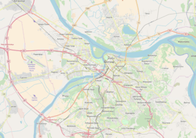 Sunčani Breg Location within Belgrade | |
| Coordinates: 44°43′38″N 20°27′17″E / 44.727314°N 20.454805°ECoordinates: 44°43′38″N 20°27′17″E / 44.727314°N 20.454805°E | |
| Country |
|
| Region | Belgrade |
| Municipality | Rakovica |
| Local community | Sunčani Breg |
| Population (2011) | |
| • Total | 3,018 |
| Time zone | UTC+1 (CET) |
| • Summer (DST) | UTC+2 (CEST) |
| Area code | +381(0)11 |
| Car plates | BG |
Sunčani Breg (Serbian: Сунчани Брег) is an urban neighborhood of Belgrade, the capital of Serbia. It is located in the Belgrade's municipality of Rakovica.
Location
Sunčani Breg is the sub-neighborhood of Miljakovac, in its southern section, close to the quarry and the neighborhood of Straževica and Jelezovac, along the road of Kružni put. To the north and north-east it extendts into the neighborhood of Miljakovac III.
The neighborhood is situated on the southeast slopes of the 209-metre-high (686 ft) Straževica hill.[1]
History
Settlement developed in the mid 1990s.[2] In plans for the urbanization of this area, it is projected as the one neighborhood with Jelezovac, Sunčani Breg-Jelezovac.
Characteristics
The name of the neighborhood is descriptive, meaning sunny hill in Serbian. In 2009 it had about 300 houses.[2]
Population
Local community of Sunčani Breg, detached from the local community of Miljakovac, had a population of 3,018 in 2011.[3]
References
External links