Sugarloaf Mountain
| Sugarloaf Mountain | |
|---|---|
 | |
| Highest point | |
| Elevation | 396 m (1,299 ft) |
| Coordinates | 22°56′55″S 43°09′26″W / 22.94861°S 43.15722°WCoordinates: 22°56′55″S 43°09′26″W / 22.94861°S 43.15722°W |
| Geography | |
 Sugarloaf Mountain Location in Rio de Janeiro | |
| Location | Rio de Janeiro, Brazil |
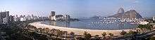

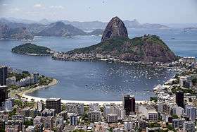
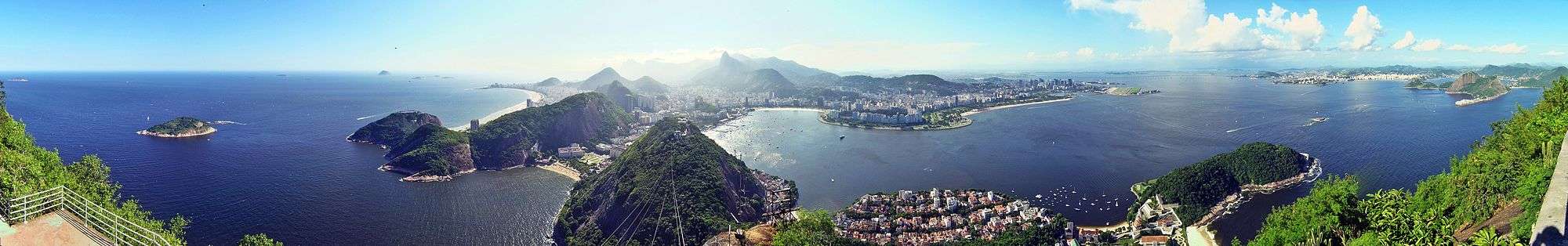
Sugarloaf Mountain (Portuguese: Pão de Açúcar pronounced [ˈpɐ̃w̃ d͡ʒi aˈsukaʁ]) is a peak situated in Rio de Janeiro, Brazil, at the mouth of Guanabara Bay on a peninsula that juts out into the Atlantic Ocean. Rising 396 m (1,299 ft) above the harbor, its name is said to refer to its resemblance to the traditional shape of concentrated refined loaf sugar. It is known worldwide for its cableway and panoramic views of the city.
The mountain is one of several monolithic granite and quartz mountains that rise straight from the water's edge around Rio de Janeiro.
The mountain is protected by the Sugarloaf Mountain and Urca Hill Natural Monument, created in 2006. This became part of a World Heritage Site declared by UNESCO in 2012.[1]
Origins of the name
The name "Sugarloaf" was coined in the 16th century by the Portuguese during the heyday of sugar cane trade in Brazil. According to historian Vieira Fazenda, blocks of sugar were placed in conical molds made of clay to be transported on ships. The shape given by these molds was similar to the peak, hence the name.
Cable car
A glass-walled cable car (bondinho or, more formally, teleférico), capable of holding 65 people, runs along a 1,400 m (4,600 ft) route between the peaks of Sugarloaf and Morro da Urca every 20 minutes. The original cable car line was built in 1912 and rebuilt around 1972–73 and in 2008. The cable car goes from a ground station, at the base of Morro da Babilônia, to Morro da Urca and thence to Sugarloaf's summit.
Reaching the summit
To reach the summit, passengers take two cable cars. The first ascends to the shorter Morro da Urca, 220 m (722 ft) high. The second car ascends to Pão de Açúcar.[2] The Swiss-made bubble-shaped cars offer passengers 360-degree views of the surrounding city. The ascent takes three minutes from start to finish.
Timeline
- 1907 – The Brazilian engineer Augusto Ferreira Ramos had the idea of linking the hills through a path in the air.
- 1910 – The same engineer founded the Society of Sugar Loaf and the same year the works were started. The project was commissioned in Germany and built by Brazilian workers. All parts were taken by climbing mountains or lift by steel cables.
- 1912 – Opening of the tram. First lift of Brazil. The first cable cars were made of coated wood and were used for 60 years.
- 1972 – The current model of cars was put into operation. This increased the carrying capacity by almost ten times.
- 2009 – Inauguration of the next generation of cable cars that had already been purchased and are on display at the base of Red beach.
Rock climbing
Visitors can watch rock climbers on Sugarloaf and the other two mountains in the area, Morro da Babilônia and Morro da Urca. Together, they form one of the largest urban climbing areas in the world, with more than 270 routes, between 1 and 10 pitches long.
Appearances in media
- Flying Down to Rio (1933) Starring Fred Astaire and Ginger Rogers. The beachside Hotel Atlântico has views across the bay looking toward Sugarloaf Mountain.
- Now, Voyager (1942) starring Bette Davis.
- In the 1979 James Bond film, Moonraker, the villainous henchman Jaws (played by Richard Kiel) attempts to kill 007 (Roger Moore) and the agent's ally, Dr. Holly Goodhead (Lois Chiles), on a cable car. However, Bond and Goodhead escape and Jaws collides with the building at the bottom of the cable car route, demolishing the building, but escaping unscathed.
- Herb Alpert recorded a song titled "Sugarloaf" for his 1982 album Fandango.
- In The Simpsons episode "Blame It on Lisa", Homer's kidnappers meet with the rest of the family for the exchange between two cable cars.
- In the Hey Arnold! episode "The Journal", Arnold's parents Miles and Stella are traveling on the cablecar up to the mountain's peak when one of the cables snaps. The couple works together to help save the lives of fellow tourists.
- In Call of Duty: Modern Warfare 2, this mountain can be seen on the "Favela" map.
- In the Nintendo Wii version of Need for Speed: Nitro, a drag race takes place near this mountain.
- In the film Rio, the mountain can be seen several times throughout the film.
- Mechanic: Resurrection (2016), starring Jason Statham. At the beginning of the film Arthur Bishop (Statham) is attacked at a restaurant on Morro da Urca and escapes on the roof of a cable car.
Gallery
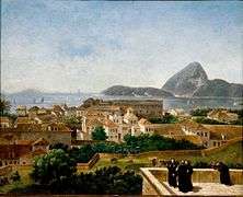 View of Sugarloaf from the terrace of the Convento de Santo Antônio (Convent of St. Anthony), c. 1816. Painting by Nicolas-Antoine Taunay.
 View of Sugarloaf from the Silvestre road, c. 1823. Painting by Charles Landseer.
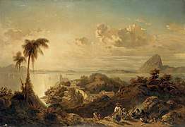 Sugarloaf as seen from Glória neighborhood, c. 1846. Painting by Eduard Hildebrandt.
_(14775856642).jpg) Sugarloaf in 1914
Sugarloaf in 1914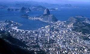 Higher aerial view, 1967
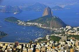 View of the Sugarloaf from Christ the Redeemer on Corcovado.
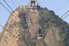 Cable cars from Sugarloaf Mountain.
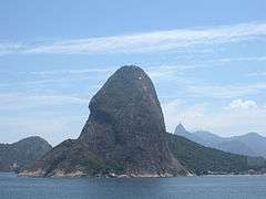 View of Sugarloaf Mountain from seaward side; Christ the Redeemer as seen in the background.
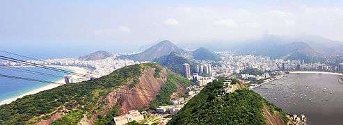 View of Rio de Janeiro from the Sugarloaf.
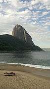 Sugarloaf as seen from the Praia Vermelha (Red beach).
- Botafogo Bay and Sugarloaf
.jpg) Botafogo Bay and beach with Sugarloaf in the background
Botafogo Bay and beach with Sugarloaf in the background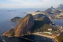 Aerial view
.jpg) Sugarloaf with Downtown Rio in the foreground
Sugarloaf with Downtown Rio in the foreground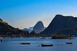 View from the city of Niterói
References
- ↑ Monumento Natural dos Morros do Pão de Açúcar e da Urca (in Portuguese), SMAC: Secretaria Municipal de Meio Ambiente, retrieved 2017-01-15
- ↑ Lonely Planet: Rio de Janeiro, page 76, Ricardo Gomes, John Maier Jr et al., 2006, Lonely Planet Publications, ISBN 1-74059-910-1
External links
| Wikimedia Commons has media related to Sugarloaf Mountain. |
- Official website
