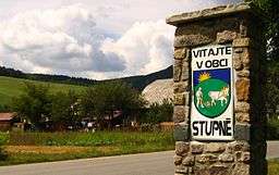
Stupné
| Stupné | |
| Village | |
 | |
| Country | Slovakia |
|---|---|
| Region | Trenčín |
| District | Považská Bystrica |
| Elevation | 340 m (1,115 ft) |
| Coordinates | 49°12′N 18°26′E / 49.200°N 18.433°ECoordinates: 49°12′N 18°26′E / 49.200°N 18.433°E |
| Area | 7.52 km2 (2.90 sq mi) |
| Population | 693 |
| Density | 92/km2 (238/sq mi) |
| First mentioned | 1416 |
  Location of Stupné in Slovakia | |
Stupné (Hungarian: Osztopna) is a village and municipality in Považská Bystrica District in the Trenčín Region of north-western Slovakia in Považie region.
History
In historical records the village was first mentioned in 1416.
Geography
The municipality lies at an altitude of 340 metres and covers an area of 7.519 km². It has a population of about 689 people.
External links
- http://travelingluck.com/Europe/Slovakia/Slovakia+(general)/_3057382_Stupn%C3%A9.html#invest - Maps of Stupné, Weather in Stupné, sunrise and sunset in Stupné
Municipalities of Považská Bystrica District | ||
|---|---|---|
This article is issued from
Wikipedia.
The text is licensed under Creative Commons - Attribution - Sharealike.
Additional terms may apply for the media files.