Stroheim
| Stroheim | ||
|---|---|---|
 | ||
| ||
 Stroheim Location within Austria | ||
| Coordinates: 48°20′20″N 13°57′30″E / 48.33889°N 13.95833°ECoordinates: 48°20′20″N 13°57′30″E / 48.33889°N 13.95833°E | ||
| Country | Austria | |
| State | Upper Austria | |
| District | Eferding | |
| Government | ||
| • Mayor | Franz Breuer (ÖVP) | |
| Area | ||
| • Total | 28.7 km2 (11.1 sq mi) | |
| Elevation | 489 m (1,604 ft) | |
| Population (14 June 2016)[1] | ||
| • Total | 1,539 | |
| • Density | 54/km2 (140/sq mi) | |
| Time zone | UTC+1 (CET) | |
| • Summer (DST) | UTC+2 (CEST) | |
| Postal code | 4074 | |
| Area code | 07272 | |
| Vehicle registration | EF | |
| Website | www.stroheim.at | |

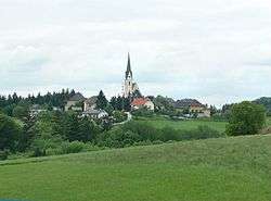
Stroheim is a municipality in the district of Eferding in the Austrian state of Upper Austria.
Geography
Stroheim lies in the Hausruckviertel on a ridge overlooking the Eferding Basin. About 29 percent of the municipality is forest and 63 percent farmland.
References
| Wikimedia Commons has media related to Stroheim. |
This article is issued from
Wikipedia.
The text is licensed under Creative Commons - Attribution - Sharealike.
Additional terms may apply for the media files.