Stratton Street
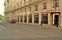
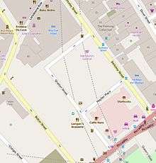
Stratton Street is a street in the City of Westminster, London. The street runs from Berkeley Street in the north to Piccadilly in the south.
History

Stratton Street started to be built in 1693 on land belonging to the estate of the first Lord Berkeley of Stratton. On some early maps it appears as Stretton Street. The street was originally a cul-de-sac, running north from Piccadilly with Devonshire House on its eastern side, but in 1924, Devonshire House was demolished and Stratton Street was extended from its northern end to Berkeley Street, giving it its current right-angled shape.[1] Mayfair Place, which joins the two streets lower down, was laid out at the same time.[2]
Notable inhabitants
Notable inhabitants have included the poet Thomas Campbell, General Thomas Graham, Lord Lynedoch, and Baroness Burdett-Coutts.[1] Ambrose, the dance band leader, lived in Stratton Street from 1927-1940. A blue plaque marks the spot.
Buildings
Numbers 6,[3] 8,[4] and 15[5] Stratton Street are all listed buildings with Historic England. Langan's Brasserie, originally the Coq D'or, is located in the street.
References
- 1 2 "Stratton Street, W1." in Christopher Hibbert; Ben Weinreb; John Keay; Julia Keay. (2010). The London Encyclopaedia. London: Pan Macmillan. p. 885. ISBN 978-0-230-73878-2.
- ↑ Hibbert, et.al., p. 536.
- ↑ Historic England. "Details from listed building database (1264239)". National Heritage List for England. Retrieved 2 October 2015.
- ↑ Historic England. "Details from listed building database (1237151)". National Heritage List for England. Retrieved 2 October 2015.
- ↑ Historic England. "Details from listed building database (1237140)". National Heritage List for England. Retrieved 2 October 2015.
External links
![]()