Strümp
| Struemp Strümp | |
|---|---|
| Subdivision of Meerbusch | |
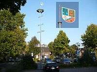 Town Center of Struemp | |
 Location in Meerbusch | |
| Coordinates: 51°17′2″N 6°39′35″E / 51.28389°N 6.65972°ECoordinates: 51°17′2″N 6°39′35″E / 51.28389°N 6.65972°E | |
| Country |
|
| State |
|
| County | Rhein-Kreis Neuss |
| Town | Meerbusch |
| Area | |
| • Total | 2.4 sq mi (6.2 km2) |
| Elevation | 115 ft (35 m) |
| Population (2007)[1] | |
| • Total | 5,836 |
| • Density | 2,438/sq mi (941.3/km2) |
| Time zone | UTC+1 (Central European Time (CET)) |
| • Summer (DST) | UTC+2 (CEST) |
| ZIP code | 40670 |
| Area code(s) | 02159 |
| Website | www.meerbusch.de |
Strümp is one of the eight districts of the city of Meerbusch, Germany. Its name is believed to be based on the stream Strempe that runs through the town and has its spring nearby.
Geography
Struemp is located in the Center of Meerbusch surrounded by all other districts. Its entire municipal area is situated on a fluvial terrace of the Lower Rhine region and therefore very flat. The so-called Strümper Berg rises barely higher than the surrounding area.
The village of Struemp consists of the town center (at Xantener Straße), two settlements (Schürkesfeld and Rottfeld/Strümper Busch) and a few farms.
References
- ↑ Information und Technik Nordrhein-Westfalen. "Estimates of the population in NRW" (in German). Archived from the original on 2011-09-28. Retrieved 2009-05-30.
Sources
This article is issued from
Wikipedia.
The text is licensed under Creative Commons - Attribution - Sharealike.
Additional terms may apply for the media files.