Stormolla
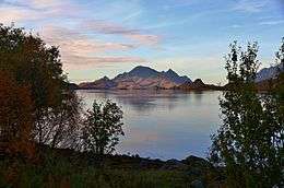 View of Stormolla | |
 Location in Lofoten | |
| Geography | |
|---|---|
| Location | Nordland, Norway |
| Coordinates | 68°15′48″N 14°50′36″E / 68.2632°N 14.8433°ECoordinates: 68°15′48″N 14°50′36″E / 68.2632°N 14.8433°E |
| Area | 35.3 km2 (13.6 sq mi) |
| Length | 10 km (6 mi) |
| Width | 5 km (3.1 mi) |
| Highest elevation | 751 m (2,464 ft) |
| Highest point | Heggedalstinden |
| Administration | |
| County | Nordland |
| Municipality | Vågan |
Stormolla [1] is an island in the municipality of Vågan in Nordland county, Norway. It is located in the Lofoten islands, south of Austvågøya and Hinnøya and northeast of Litlmolla and Skrova.
The 35.3-square-kilometre (13.6 sq mi) island has a ferry connection from the northern tip of the island to the village of Digermulen on the neighboring island of Hinnøya. Most of the 55 residents (2005) live in the small fishing village of Brettesnes on the southern tip of the island.[2]
References
- ↑ Stormolla, Kartverket, Faktaark, retrieved, 9 February 2017
- ↑ Store norske leksikon. "Stormolla" (in Norwegian). Retrieved 2012-07-13.
This article is issued from
Wikipedia.
The text is licensed under Creative Commons - Attribution - Sharealike.
Additional terms may apply for the media files.