Stone Lake (CDP), Wisconsin
| Stone Lake, Wisconsin | |
|---|---|
| Census-designated place | |
 Stone Lake, Wisconsin | |
| Coordinates: 45°50′44″N 91°32′26″W / 45.84556°N 91.54056°WCoordinates: 45°50′44″N 91°32′26″W / 45.84556°N 91.54056°W | |
| Country | United States |
| State | Wisconsin |
| Counties | Sawyer and Washburn |
| Area | |
| • Total | 1.774 sq mi (4.59 km2) |
| • Land | 0.940 sq mi (2.43 km2) |
| • Water | 0.834 sq mi (2.16 km2) |
| Elevation | 1,316 ft (401 m) |
| Population (2010) | |
| • Total | 178 |
| • Density | 100/sq mi (39/km2) |
| Time zone | UTC-6 (Central (CST)) |
| • Summer (DST) | UTC-5 (CDT) |
| Area code(s) | 715 & 534 |
| GNIS feature ID | 1574928[1] |
Stone Lake is an unincorporated census-designated place in Sawyer and Washburn counties, Wisconsin, United States. Stone Lake is located on the eastern shore of Stone Lake and along Wisconsin Highway 70, 12 miles (19 km) west-northwest of Couderay. The Sawyer County portion of the community is located in the town of Sand Lake, while the Washburn County portion is located in the town of Stone Lake. As of the 2010 census, its population is 178.[2]
References
Municipalities and communities of Sawyer County, Wisconsin, United States | ||
|---|---|---|
| City | 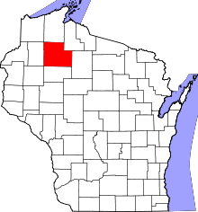 | |
| Villages | ||
| Towns | ||
| CDPs | ||
| Unincorporated communities | ||
| Indian reservation | ||
| Footnotes | ‡This populated place also has portions in an adjacent county or counties | |
Municipalities and communities of Washburn County, Wisconsin, United States | ||
|---|---|---|
| Cities | 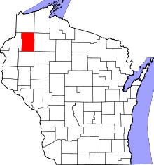 | |
| Villages | ||
| Towns | ||
| CDPs | ||
| Unincorporated communities | ||
| Ghost town/neighborhood | ||
| Indian reservation | ||
| Footnotes | ‡This populated place also has portions in an adjacent county or counties | |
This article is issued from
Wikipedia.
The text is licensed under Creative Commons - Attribution - Sharealike.
Additional terms may apply for the media files.