Stockhorn (Zermatt)
| Stockhorn | |
|---|---|
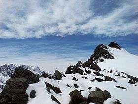 View from the east side | |
| Highest point | |
| Elevation | 3,532 m (11,588 ft) |
| Prominence | 145 m (476 ft) [1] |
| Parent peak | Monte Rosa (Dufourspitze) |
| Coordinates | 45°59′8″N 7°50′16″E / 45.98556°N 7.83778°ECoordinates: 45°59′8″N 7°50′16″E / 45.98556°N 7.83778°E |
| Geography | |
 Stockhorn Location in Switzerland | |
| Location | Valais, Switzerland |
| Parent range | Pennine Alps |
The Stockhorn (3,532 m) is a mountain of the Swiss Pennine Alps, located to the southeast of the town of Zermatt. It lies on the range between the Findel and Gorner glaciers, east of the Gornergrat.
The Stockhorn is part of the Zermatt ski area. A now-defunct cable car station at an altitude of 3,405 m is located west of the summit; the original aerial tramway connecting the Gornergrat to the Stockhorn via Hohtälli was dismantled in 2007.[2][3]
References
- ↑ Retrieved from the Swisstopo topographic maps. The key col is the Stockhornpass (3,387 m).
- ↑ Stockhorn lifts on Seilbahn Nostalgie (in German)
- ↑ End of Gornergrat tram service - Funimag.com
External links
| Wikimedia Commons has media related to Stockhorn (Zermatt). |
This article is issued from
Wikipedia.
The text is licensed under Creative Commons - Attribution - Sharealike.
Additional terms may apply for the media files.