Steinfeld, Lower Saxony
| Steinfeld | ||
|---|---|---|
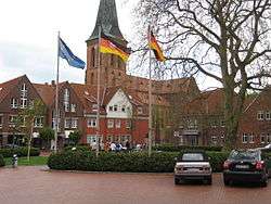 Town centre | ||
| ||
 Steinfeld Location of Steinfeld within Vechta district _in_VEC.svg.png)  | ||
| Coordinates: 52°36′N 8°13′E / 52.600°N 8.217°ECoordinates: 52°36′N 8°13′E / 52.600°N 8.217°E | ||
| Country | Germany | |
| State | Lower Saxony | |
| District | Vechta | |
| Government | ||
| • Mayor | Manuela Honkomp (Ind.) | |
| Area | ||
| • Total | 60 km2 (20 sq mi) | |
| Elevation | 47 m (154 ft) | |
| Population (2017-12-31)[1] | ||
| • Total | 10,010 | |
| • Density | 170/km2 (430/sq mi) | |
| Time zone | CET/CEST (UTC+1/+2) | |
| Postal codes | 49439 | |
| Dialling codes | 05492 | |
| Vehicle registration | VEC | |
| Website | www.steinfeld.de | |

Steinfeld is a municipality in the district of Vechta, in Lower Saxony, Germany. It is situated approximately 16 km southwest of Vechta, and 40 km northeast of Osnabrück.
| Wikimedia Commons has media related to Steinfeld, Lower Saxony. |
Towns and municipalities in Vechta (district) | ||
|---|---|---|
References
This article is issued from
Wikipedia.
The text is licensed under Creative Commons - Attribution - Sharealike.
Additional terms may apply for the media files.