Steamboat Springs (Nevada)
| Steamboat Springs | |
|---|---|
 Fumarole at Steamboat Springs, Nevada | |
| Highest point | |
| Elevation | 1,415 m (4,642 ft) [1] |
| Coordinates | 39°22′30″N 119°43′12″W / 39.375°N 119.72°WCoordinates: 39°22′30″N 119°43′12″W / 39.375°N 119.72°W [1] |
| Geography | |
| Location | Washoe County, Nevada, United States |
| Geology | |
| Age of rock | |
| Reference no. | 198 |
| Mountain type | lava domes[2] |
Steamboat Springs is a small volcanic field of rhyolitic lava domes and flows in western Nevada, located south of Reno. There is extensive geothermal activity in the area, including numerous hot springs, steam vents, and fumaroles.[1] The residential portions of this area, located mostly east of Steamboat Creek and south of modern-day SR 341, are now known simply as Steamboat.
The state of Nevada has a Steamboat Springs Historical Marker (#198) situated along the eastern shoulder of the busy Carson–Reno Highway (US 395 Alt.), approximately 1.65 miles (2.66 km) south of the Mount Rose Junction (the intersection with SR 341 and SR 431). There were once several mineral spas operating here along Steamboat Creek, with at least one still in business.
History
Established in 1860 by Frenchman, Felix Monet, the hot springs served in previous years as a welcoming watering place for wagons traveling west.[3] In the early days, when the air was cool and calm, William Wright reported that as many as sixty or seventy columns of steam could be seen.[4]
In the early 1860's, cottages, a bathhouse and a hospital were built near the springs, but many buildings were destroyed by a fire in 1867. In the early 1870's, a hotel was built to shelter 50 guests. Along with a new drugstore, cottages and 15 medicinal bathing facilities, the town became a popular spa with miners, tourists and people seeking health treatments.[3]
The Virginia & Truckee Railroad reached Steamboat Springs from Reno in 1871[3]. In 1871, with tracks yet to be built south through the Washoe Valley to Carson City, this temporary rail terminus became an important transfer point for passengers and freight heading up the Geiger Grade on stagecoaches bound for Virginia City and the mines of the Comstock Lode. Once tracks were extended south the following summer to meet the existing Carson-Virginia City rail line, such transfer business fell off rapidly. Resort facilities continued to operate for many years.[3]
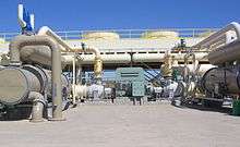
Geysers have been active until the 1980s when a geothermal power plant has been erected.
Name
Mark Twain wrote in August 1863 "... From one spring the boiling water is ejected a foot or more by the infernal force at work below, and in the vicinity of all of them one can hear a constant rumbling and surging, somewhat resembling the noises peculiar to a steamboat in motion - hence the name" [4]
References
- 1 2 3 4 "Steamboat Springs". Global Volcanism Program. Smithsonian Institution. Retrieved 2008-09-04.
- ↑ Wood, Charles A.; Jűrgen Kienle (1993). Volcanoes of North America. Cambridge University Press. pp. 156–258. ISBN 0-521-43811-X.
- 1 2 3 4 Paher, Stanley W. (1970). Nevada Ghost Towns and Mining Camps. Howell-North Books. p. 41.
- 1 2 Carlson, Helen S. (1985). Nevada place names : a geographical dictionary. Reno: University of Nevada Press. p. 223. ISBN 0-87417-094-X.