Starkey Township, Logan County, North Dakota
Starkey Township was a township in Logan County, North Dakota, United States.[1] The former township was merged into the West Logan Unorganized Territory.[2][3]
As of the 2000 census the township's population was 44, it covered an area containing 36.105 square miles (93.51 km2) of land and no water, and it was located at 46°24′52″N 99°44′18″W / 46.414434°N 99.738411°W.[4][5] The elevation was 2,119 feet (646 m).[1]
The township was located in the western part of the county and it bordered the following other townships within Logan County:[6]
- Bryant Township (defunct) — north
- Dixon Unorganized Territory (defunct, formerly Dixon Township) — northeast corner
- Red Lake Township — east
References
- 1 2 "Township of Starkey (historical)". Geographic Names Information System. United States Geological Survey. Retrieved June 29, 2013.
- ↑ "Geographic Change Notes for North Dakota". United States Census Bureau. Archived from the original (TXT) on October 10, 2012. Retrieved June 29, 2013.
- ↑ "Unorganized Territory of West Logan". Geographic Names Information System. United States Geological Survey. Retrieved June 29, 2013.
- ↑ U.S. Census Bureau. Census 2000. "Census Demographic Profiles, Starkey township, Logan County, North Dakota" (PDF). CenStats Databases. Retrieved June 30, 2013.
- ↑
"County Subdivisions". 2000 Census Gazetteer Files. United States Census Bureau. Archived from the original (Zipped text file) on November 7, 2013. Retrieved June 30, 2013. External link in
|work=(help) - ↑ "Maps of North Dakota county subdivisions (Logan County on page 6)" (PDF). United States Census Bureau. 2000. Retrieved June 29, 2013.
Municipalities and communities of Logan County, North Dakota, United States | ||
|---|---|---|
| Cities | 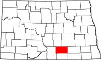 | |
| Townships | ||
| Former townships | ||
| Unorganized territories |
| |
| Unincorporated communities |
| |
| Footnotes | ‡This populated place also has portions in an adjacent county or counties | |
Coordinates: 46°24′50″N 99°42′31″W / 46.41389°N 99.70861°W
This article is issued from
Wikipedia.
The text is licensed under Creative Commons - Attribution - Sharealike.
Additional terms may apply for the media files.