Star Trek Maps
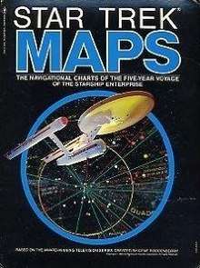 Box art | |
| Authors | Jeffrey Maynard, John Upton, et al. |
|---|---|
| Illustrators | Jeffrey Maynard, Michael McMaster, et al. |
| Country | United States |
| Language | English |
| Series | Star Trek (Bantam Books) |
| Genre | Science fiction |
| Publisher | Bantam Books |
Publication date | August 1980 |
| Media type | |
| Pages | 31 pp., 4 maps |
| ISBN | 0-553-01202-9 |
Star Trek Maps is a reference work demonstrating the stellar cartography and navigation system featured on the Star Trek television series, written from an in-universe perspective. It was published by Bantam Books in August 1980, and licensed by Paramount Pictures.
The box set included four four-color wall maps, and an instructional booklet from the "Technical Publications Section" of Starfleet Command.
Production
A number of artists contributed to the production of the booklet, and wall maps. Many of the contributors would work on later Star Trek productions.
- Jeffrey Maynard, Co-designer and coordinator.
- Michael McMaster, Concept artist. Self-published Star Trek blueprint sets 1975–78, under the name "Galactic Designs and Productions."[1]
- Geoffrey Mandel, Astronomical art design. Was a member of the art department on Star Trek Generations, Deep Space Nine, and Voyager.
- Lee Cole, Technical graphics. Scenic artist for the unproduced Phase II, The Motion Picture and The Wrath of Khan.
- Michael Nicastre and Rick Sternbach, Airbrush art. Sternbach was a production illustrator for The Motion Picture, The Next Generation, Deep Space Nine, and Voyager.
- John Upton, instruction manual author.
- Sydny Weinberg, editor. Weinberg was credited as an editor at Bantam Books.
- Larry Nemecek, uncredited consultant. Nemecek contributed technical material, which was included in the sidebars on each of the maps.
Contents
Star Trek Maps box set contains four four-color wall maps, and a 31-page staple-bound booklet.[2]
- Introduction to Navigation (booklet): Labelled with an in-universe document number: TM:3001499-03, as published by the Technical Publications Section of Starfleet Command. The text includes historical background, explanations of warp travel, navigation within the Federation, a briefing on course calculations, which include vector calculus, a table of corrections for warp speed designations.
- Chart A: United Federation of Planets. Plots the locations of the core Federation member worlds, and their relation to Earth. Sidebars include projections, called “Astrogation” in the key, of the coordinate system, and prime directions, explained in the booklet, in eight specifications: Galaxy down to individual sector.
- Chart B: Named Planets and their Primaries, and Planetary Descriptions. Plots location of named planets from the television series using a galactic side view. Sidebars include vector drawings of Federation vessels and buoys, and two maps of member worlds more distant from the Federation core.
- Chart C: Enterprise Zone of Patrol Map Five, with scaled maps of the Klingon Empire and an updated map of Earth Outpost Sector Z-6 featured in “Balance of Terror”. Sidebar features planetary layouts of Sol, Triskelion, Talos, Deneb and Gamma Vertis systems.
- Chart D: Enterprise Zone of Patrol Map Six. Sidebars are a detailed map of the Rigel system, and depictions of twelve words, including Memory Alpha, Sherman’s Planet, Babel, and Vulcan.
Reception
William A. Barton reviewed the box set in The Space Gamer No. 34, saying that "Star Trek fans of Earth owe a vote of thanks to designer Jeffrey Maynard and to Bantam for taking the time to release these… They should prove a worthwhile purchase to anyone interested in the Star Trek universe."[2]
According to Memory Alpha, maps from the set were featured as part of the 1992 Star Trek exhibition presented by the National Air & Space Museum.
Nemecek created a similarly in-depth package of wall maps and encyclopedic booklet in 2013, released as Stellar Cartography: The Starfleet Reference Library. The maps and text were updated by Nemecek to include information from other Star Trek spin-off series, and films released since 1980, combined with material he contributed to Star Trek: Star Charts (2002).
References
External links
- Star Trek Maps at Memory Alpha (a Star Trek wiki)
- Star Trek Maps at Goodreads
- Star Trek Maps at Memory Beta