Stansbury Mountains
| Stansbury Mountains | |
|---|---|
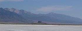 View south-southeast, from Timpie area | |
| Highest point | |
| Peak | Deseret Peak |
| Elevation | 11,035 ft (3,363 m) |
| Coordinates | 40°27′34.25″N 112°37′34.76″W / 40.4595139°N 112.6263222°W |
| Dimensions | |
| Length | 28 mi (45 km) N-S |
| Geography | |
 Stansbury Mountains in Utah | |
| Country | United States |
| State | Utah |
| Regions | Great Basin Desert and Great Salt Lake Desert |
| County | Tooele |
| Communities |
List
|
| Range coordinates | 40°31′02″N 112°38′01″W / 40.5171636°N 112.6335728°WCoordinates: 40°31′02″N 112°38′01″W / 40.5171636°N 112.6335728°W |
| Borders on |
|
The Stansbury Mountains are a 28-mile (45 km) long[1] mountain range located in eastern Tooele County, Utah.[2] The north end of the range borders the southwest of the Great Salt Lake at Stansbury Bay.
The range trends north-south, and lies in the region of the southeast Great Salt Lake Desert. Dugway (and the Dugway Proving Ground) is adjacent southwest at the desert's perimeter; Skull Valley trends north from Dugway, and is the west border of the Stansbury Mountains.
The south of the range contains the Deseret Peak Wilderness, with much of the range as part of the Uinta-Wasatch-Cache National Forest.
Description
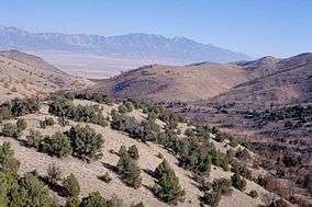
The range trends north-south, and is connected with a similar trending range at the south, the Onaqui Mountains. The range is widest at the south, about 10-mi, and narrows to about 6-mi[3] at the Great Salt Lake.
The highpoint of the range is Deseret Peak, 11,035 feet (3,363 m), in the Deseret Peak Wilderness. The range is mostly a massif, with a continuous ridgeline from north-to-south; the last 3-mi north narrows to Long Rock Basin at Timpie. Timpie Springs Waterfowl Management Area at the lakeshore, borders Timpie, and the range's foothill.
Skull Valley borders the range's west, with the Skull Valley Indian Reservation at the southwest foothills, and north of Dugway. Tooele Valley borders the range's east, with the communities of Burmester, Grantsville, and Rush Valley.
Access
Utah State Route 196 traverses the Skull Valley from Dugway south, to Iosepa, valley center, then to Timpie. Only unimproved roads access the west side of the range.
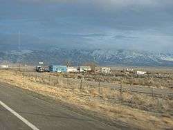
The east side of the range contains numerous communities, and the Tooele Army Depot at multiple sites. Utah Route 138 traverses the range's northeast to Grantsville from I-80. Interstate 80 lies at the north end of the range at Timpie, connecting Delle west to Burmester east.
See also
References
- ↑ Utah, DeLorme Atlas & Gazetteer, p. 16-17, 24-25.
- ↑ U.S. Geological Survey Geographic Names Information System: Stansbury Mountains
- ↑ DeLorme Atlas, p. 16-17.
External links
| Wikimedia Commons has media related to Stansbury Mountains. |