Stanošina
| Stanošina | |
|---|---|
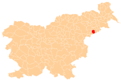
 Stanošina Location in Slovenia | |
| Coordinates: 46°19′3.23″N 15°52′35.44″E / 46.3175639°N 15.8765111°ECoordinates: 46°19′3.23″N 15°52′35.44″E / 46.3175639°N 15.8765111°E | |
| Country |
|
| Traditional region | Styria |
| Statistical region | Drava |
| Municipality | Podlehnik |
| Area | |
| • Total | 3.34 km2 (1.29 sq mi) |
| Elevation | 241.8 m (793.3 ft) |
| Population (2002) | |
| • Total | 164 |
| [1] | |
Stanošina (pronounced [ˈstaːnɔʃina]) is a settlement in the Haloze Hills in the Municipality of Podlehnik in eastern Slovenia. It stretches along the main road south of Podlehnik towards the border with Croatia. The area traditionally belonged to the Styria region. It is now included in the Drava Statistical Region.[2]
The local church is dedicated to Our Lady of Sorrows and belongs to the Parish of Sveta Trojica–Podlehnik. The church was built between 1743 and 1773.[3]
References
External links
| Settlements | Administrative centre: Podlehnik
|  |
|---|---|---|
| Landmarks |
| |
This article is issued from
Wikipedia.
The text is licensed under Creative Commons - Attribution - Sharealike.
Additional terms may apply for the media files.