Staniforth Range
| Staniforth Range | |
|---|---|
 | |
| Elevation | 1,577 metres (5,174 ft) |
| Geography | |
| Country |
|
| State/Province | Gulf Province |
| Range coordinates | 7°17′S 145°42′E / 7.283°S 145.700°ECoordinates: 7°17′S 145°42′E / 7.283°S 145.700°E |
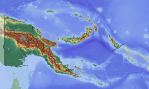
Staniforth Range is a mountain range located in Gulf Province, Papua New Guinea.[1] Yeripa and Taripa villages are the nearest populated places to the range.[2] [3]
History
The mountain range is named after Miles Staniforth Cater Smith, an Australian politician who played a role in the passing of the Papua Act 1905 which saw the transfer of the territory of Papua from Britain to Australia.[4][5][6]
References
- ↑ Staniforth Range: Papua New Guinea National Geospatial-Intelligence Agency, Bethesda, MD, USA
- ↑ Yeripa: Papua New Guinea National Geospatial-Intelligence Agency, Bethesda, MD, USA
- ↑ Taripa Map
- ↑ Gibbney, H. J. Australian Dictionary of Biography. National Centre of Biography, Australian National University – via Australian Dictionary of Biography.
- ↑ Carr, Adam. "Psephos - Adam Carr's Election Archive". psephos.adam-carr.net.
- ↑ "Staniforth Place Names". staniforthfamily.com.
This article is issued from
Wikipedia.
The text is licensed under Creative Commons - Attribution - Sharealike.
Additional terms may apply for the media files.