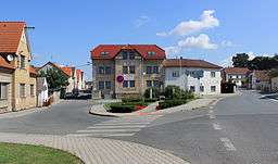
Staňkov (Domažlice District)
| Staňkov | |||
| Town | |||
 | |||
|
|||
| Country | Czech Republic | ||
|---|---|---|---|
| Region | Plzeň | ||
| District | Domažlice | ||
| Commune | Horšovský Týn | ||
| Municipality | Staňkov | ||
| Parts | Krchleby, Ohučov, Staňkov I, Staňkov II, Vránov | ||
| Elevation | 387 m (1,270 ft) | ||
| Coordinates | 49°33′14″N 13°4′15″E / 49.55389°N 13.07083°ECoordinates: 49°33′14″N 13°4′15″E / 49.55389°N 13.07083°E | ||
| Area | 20.48 km2 (7.91 sq mi) | ||
| Population | 3,276 (2015-01-01) | ||
| Density | 160/km2 (414/sq mi) | ||
| First mentioned | 1233 | ||
| Timezone | CET (UTC+1) | ||
| - summer (DST) | CEST (UTC+2) | ||
| Postal code | 344 01 - 345 61 | ||
  Location in the Czech Republic | |||
| Wikimedia Commons: Staňkov | |||
| Statistics: statnisprava.cz | |||
| Website: www.mestostankov.cz | |||
_vlajka.jpg)
_CoA.jpg)
| Staňkov | |
| Municipality with Commissioned Local Authority | |
| Country | Czech Republic |
|---|---|
| Region | Plzeň |
| Little District | Horšovský Týn |
| Municipalities | Čermná, Hlohová, Hlohovčice, Močerady, Osvračín, Poděvousy, Puclice, Staňkov |
| Area | 68.19 km2 (26 sq mi) |
| Population | 4,961 (2005-12-31) |
| Density | 73/km2 (189/sq mi) |
Staňkov (Czech pronunciation: [ˈstaɲkof]) is a town in the Plzeň Region of the Czech Republic. It lies on the Radbuza River, some 30 km (19 mi) to the southwest from the region capital of Plzeň.
Staňkov is also a Municipality with Commissioned Local Authority within the Horšovský Týn Municipality with Extended Competence.
During the Second World War, the metalworks in Staňkov were accidentally bombed by the RAF on 28 October 1940 when they were mistaken for the nearby Škoda Works.[1]
Resources
- Czech Statistical Office (2005), Vybrané údaje podle správních obvodů obcí s rozšířenou působností a správních obvodů obcí s pověřeným obecním úřadem k 31. 12. 2005, retrieved 2005-03-08
References
- ↑ National Archives: FO 370/24292/10821
External links

This article is issued from
Wikipedia.
The text is licensed under Creative Commons - Attribution - Sharealike.
Additional terms may apply for the media files.