St. George, Alaska
| St. George | |
|---|---|
| City | |
 Aerial view of St. George harbor | |
 St. George Location in Alaska | |
| Coordinates: 56°36′20″N 169°33′35″W / 56.60556°N 169.55972°W | |
| Country | United States |
| State | Alaska |
| Census Area | Aleutians West |
| Incorporated | September 13, 1983[1] |
| Government | |
| • Mayor | Patrick Pletnikoff[2] |
| • State senator | Lyman Hoffman (D) |
| • State rep. | Bryce Edgmon (D) |
| Area[3] | |
| • Total | 182.31 sq mi (472.17 km2) |
| • Land | 34.75 sq mi (90.00 km2) |
| • Water | 147.56 sq mi (382.17 km2) |
| Elevation | 197 ft (60 m) |
| Population (2010) | |
| • Total | 102 |
| • Estimate (2016)[4] | 105 |
| • Density | 0.58/sq mi (0.22/km2) |
| Time zone | UTC-9 (Alaska (AKST)) |
| • Summer (DST) | UTC-8 (AKDT) |
| ZIP code | 99591 |
| Area code | 907 |
| FIPS code | 02-65800 |
| Website | stgeorgealaska.com |
St. George (Aleut: Anĝaaxchalux̂) is a city in Aleutians West Census Area, Alaska, United States. At the 2010 census the population was 102, down from 152 in 2000. It is the main settlement of St. George Island in the Pribilofs, a small island group in the Bering Sea.
Geography
St. George is located at 56°36′20″N 169°33′35″W / 56.60556°N 169.55972°W (56.605546, -169.559584).[5]
According to the U.S. Census Bureau, the city has a total area of 182.4 square miles (472 km2), of which, 34.8 square miles (90 km2) of it is land and 147.6 square miles (382 km2) of it (80.94%) is water.
The city is served by an airport with scheduled service to St. Paul Island Airport and Unalaska Airport provided by Grant Aviation.
Demographics
| Historical population | |||
|---|---|---|---|
| Census | Pop. | %± | |
| 1880 | 92 | — | |
| 1890 | 93 | 1.1% | |
| 1910 | 90 | — | |
| 1920 | 138 | 53.3% | |
| 1930 | 153 | 10.9% | |
| 1940 | 183 | 19.6% | |
| 1950 | 187 | 2.2% | |
| 1960 | 264 | 41.2% | |
| 1970 | 163 | −38.3% | |
| 1980 | 158 | −3.1% | |
| 1990 | 138 | −12.7% | |
| 2000 | 152 | 10.1% | |
| 2010 | 102 | −32.9% | |
| Est. 2016 | 105 | [4] | 2.9% |
| U.S. Decennial Census[6] | |||
St. George first appeared on the 1880 U.S. Census as an unincorporated Aleut village. Of its 92 residents, 88 were Aleut and 4 were White.[7] It returned again in 1890 with 93 residents, reporting 49 Natives (presumably Aleut), 36 Creoles (Mixed Russian & Native), and 8 Whites. It did not report on the 1900 census. From 1910-40, it reported as "St. George Island." In 1950, it reported as St. George. In 1960, it reported again as "St. George Island." From 1970-onwards, it has reported as St. George. It formally incorporated in 1983.
As of the census[8] of 2000, there were 152 people, 51 households, and 42 families residing in the city. The population density was 4.4 people per square mile (1.7/km²). There were 67 housing units at an average density of 1.9 per square mile (0.7/km²). The racial makeup of the city was 92.11% Alaska Native and 7.89% White.
There were 51 households out of which 47.1% had children under the age of 18 living with them, 54.9% were married couples living together, 15.7% had a female householder with no husband present, and 17.6% were non-families. 15.7% of all households were made up of individuals and none had someone living alone who was 65 years of age or older. The average household size was 2.98 and the average family size was 3.29.
In the city, the age distribution of the population shows 36.8% under the age of 18, 5.3% from 18 to 24, 31.6% from 25 to 44, 19.7% from 45 to 64, and 6.6% who were 65 years of age or older. The median age was 33 years. For every 100 females, there were 92.4 males. For every 100 females age 18 and over, there were 113.3 males.
The median income for a household in the city was $57,083, and the median income for a family was $60,625. Males had a median income of $50,625 versus $31,250 for females. The per capita income for the city was $21,131. About 4.9% of families and 7.9% of the population were below the poverty line, including 4.0% of those under the age of eighteen and none of those sixty five or over.
Education
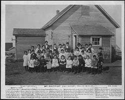
St. George is served by the Pribilof Island School District. In 2004 the district began offering 9-12th grade to St. George students via video conference. Students have a choice: they can live at home and attend distance education classes or they can leave home and attend a boarding school.
St. George School covers grades K-8 and serves St. George. The nearby St. Paul School in St. Paul serves grades K-12.
References
- ↑ 1996 Alaska Municipal Officials Directory. Juneau: Alaska Municipal League/Alaska Department of Community and Regional Affairs. January 1996. p. 128.
- ↑ 2015 Alaska Municipal Officials Directory. Juneau: Alaska Municipal League. 2015. p. 134.
- ↑ "2016 U.S. Gazetteer Files". United States Census Bureau. Retrieved Jun 22, 2017.
- 1 2 "Population and Housing Unit Estimates". Retrieved June 9, 2017.
- ↑ "US Gazetteer files: 2010, 2000, and 1990". United States Census Bureau. 2011-02-12. Retrieved 2011-04-23.
- ↑ "Census of Population and Housing". Census.gov. Retrieved June 4, 2015.
- ↑ http://www2.census.gov/prod2/decennial/documents/1890a_v8-01.pdf
- ↑ "American FactFinder". United States Census Bureau. Retrieved 2008-01-31.
External links
- Official website
- St. George Tanaq Corporation Website
- Historic American Buildings Survey (HABS) No. AK-63, "Village of St. George, St. George, Aleutians West Census Area, AK"
Coordinates: 56°36′20″N 169°33′35″W / 56.605546°N 169.559584°W
Municipalities and communities of Aleutians West Census Area, Alaska, United States | ||
|---|---|---|
| Cities | 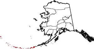 | |
| CDPs | ||