Spurwink River
| Spurwink River | |
|---|---|
.jpg) A Hudsonian godwit (left) and a greater yellowlegs located north of the river. | |
 | |
| Country | United States |
| Physical characteristics | |
| Main source | Maine |
| Length | 4.6 mi (7.4 km)[1] |
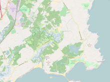
The Spurwink River is a 4.6-mile-long (7.4 km)[1] primarily tidal river in Cumberland County, Maine, in the United States. It rises in the town of Cape Elizabeth and flows west, then southwest, through salt marshes to its mouth at the Atlantic Ocean. It is bridged by Maine State Route 77 at the river's approximate halfway point. From a point shortly above the bridge to the river's mouth, it forms the boundary between Cape Elizabeth to the east and the town of Scarborough to the west. The river's mouth is at the Scarborough village of Higgins Beach.
See also
References
- 1 2 U.S. Geological Survey. National Hydrography Dataset high-resolution flowline data. The National Map, accessed June 30, 2011
- U.S. Geological Survey Geographic Names Information System: Spurwink River
- Maine Streamflow Data from the USGS
- Maine Watershed Data From Environmental Protection Agency
Coordinates: 43°33′28″N 70°16′21″W / 43.55786°N 70.27255°W
This article is issued from
Wikipedia.
The text is licensed under Creative Commons - Attribution - Sharealike.
Additional terms may apply for the media files.