Spital am Pyhrn
| Spital am Pyhrn | ||
|---|---|---|
 | ||
| ||
 Spital am Pyhrn Location within Austria | ||
| Coordinates: 47°39′55″N 14°20′27″E / 47.66528°N 14.34083°ECoordinates: 47°39′55″N 14°20′27″E / 47.66528°N 14.34083°E | ||
| Country | Austria | |
| State | Upper Austria | |
| District | Kirchdorf an der Krems | |
| Government | ||
| • Mayor | Aegidius Exenberger (SPÖ) | |
| Area | ||
| • Total | 108.9 km2 (42.0 sq mi) | |
| Elevation | 640 m (2,100 ft) | |
| Population (14 June 2016)[1] | ||
| • Total | 2,234 | |
| • Density | 21/km2 (53/sq mi) | |
| Time zone | UTC+1 (CET) | |
| • Summer (DST) | UTC+2 (CEST) | |
| Postal code | 4582 | |
| Area code | 07563 | |
| Vehicle registration | KI | |
| Website | www.spital-pyhrn.at | |

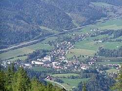
Spital am Pyhrn is a municipality in the district of Kirchdorf an der Krems in the Austrian state of Upper Austria.
Geography
Spital lies in the Traunviertel. About 48 percent of the municipality is forest, and 19 percent is farmland.
 View from Pacherkogel
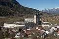
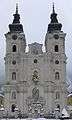 Former monastery in winter
 In the parish church
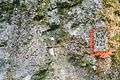 Engravings on rocks
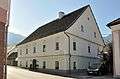 Former mansion of forgery
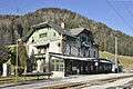 Railway station
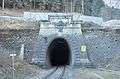 Northportal of railway tunnel Bosruck
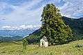 Chapel Ochsenwald
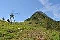 Arlingsattel - mountain pass
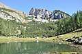 Lake Brunnsteiner
 Alpine pasture Schmiedalm
References
| Wikimedia Commons has media related to Spital am Pyhrn. |
| Authority control |
|---|
This article is issued from
Wikipedia.
The text is licensed under Creative Commons - Attribution - Sharealike.
Additional terms may apply for the media files.