Spencer Place
Coordinates: 53°48′50″N 1°31′30″W / 53.814°N 1.525°W
Spencer Place is a road that runs approximately North-South between Harehills and Chapeltown in the city of Leeds, West Yorkshire, England. At the north end it intersects with Harehills Lane, at the corner of Potternewton Park. At the south end it forms a junction with Roundhay Road. It is home to the Leeds Jamia Mosque and Chapeltown Health Centre. [1][2][3] Spencer Place is used as part of the Chapeltown Carnival.
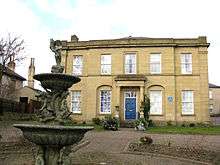
Newton House: one of a few grand houses still present, built about 1820
References
This article is issued from
Wikipedia.
The text is licensed under Creative Commons - Attribution - Sharealike.
Additional terms may apply for the media files.