Spånga-Tensta
| Spånga-Tensta | |
|---|---|
| Borough of Stockholm | |
 View of Tensta | |
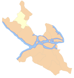 Location within Stockholm | |
| Coordinates: 59°23′39″N 17°54′04″E / 59.39417°N 17.90111°ECoordinates: 59°23′39″N 17°54′04″E / 59.39417°N 17.90111°E | |
| Country |
|
| Municipality | Stockholm |
| Municipal part | Västerort |
| Established | 2007 |
| Area | |
| • Total | 12.85 km2 (4.96 sq mi) |
| Population (2014) | |
| • Total | 39,082 |
| • Density | 3,000/km2 (7,900/sq mi) |
| Website | Spånga-Tensta at stockholm.se |
Spånga-Tensta is a borough (stadsdelsområde) in Stockholm, Sweden located in the north. The districts that make up the borough are Bromsten, Flysta, Lunda, Solhem, Sundby and Tensta. A large portion of the uninhabited field Järvafältet belongs to the districts of Akalla and Husby.
Overview
The borough consists of following places:
These parts are created with the rest of the 70- and 80-s city districts in the ABC style: Arbete-Bostad-Centrum (meaning Work-Home-Centre, place to work, to live in and local centres).
The population as of 2004 is 34,448 on an area of 12.85 km², which gives a density of 2,680.78/km².
Transport
The transport provided is:
- Rail: Metro Blue line (T-banan), running from Kungsträdgården in city centre to Hjulsta station in the north. It has two stations, Hjulsta and Tensta, both inaugurated with the opening in 1975. Commuter rail has one station, Spånga, serving central parts of Bromsten.
- Bus: Several lines serve the borough.
- Car: When finished, the Förbifart Stockholm will provide a motorway to be built to lighten traffic at E4/E20. In 2005, however, E18 Hjulstavägen runs on the north of Hjulsta/Tensta, creating a border between the green area and the city zone.
External links
![]()
This article is issued from
Wikipedia.
The text is licensed under Creative Commons - Attribution - Sharealike.
Additional terms may apply for the media files.