South Plains, Texas
| South Plains, Texas | |
|---|---|
| Unincorporated community | |
 Wind farm near South Plains | |
 South Plains Location within the state of Texas  South Plains South Plains (the US) | |
| Coordinates: 34°13′28″N 101°18′35″W / 34.22444°N 101.30972°WCoordinates: 34°13′28″N 101°18′35″W / 34.22444°N 101.30972°W | |
| Country | United States |
| State | Texas |
| County | Floyd |
| Elevation | 3,215 ft (980 m) |
| Time zone | UTC-6 (Central (CST)) |
| • Summer (DST) | UTC-5 (CDT) |
| ZIP codes | 79258 |
| GNIS feature ID | 1368739 |
South Plains is an unincorporated community in northern Floyd County, Texas, United States. It lies along State Highway 207 north of the city of Floydada, the county seat of Floyd County.[1] Its elevation is 3,215 feet (980 m).[2] Although South Plains is unincorporated, it has a post office, with the ZIP code of 79258.[3]
A post office was established at South Plains in 1909, several miles from the current location; it was moved twice before reaching the current location in 1927, along the Fort Worth and Denver Railway. The community flourished in the 1920s, with a school and businesses being established, but the coming of the Great Depression led to a decline of population.[4]
See also
References
- ↑ Rand McNally. The Road Atlas '08. Chicago: Rand McNally, 2008, p. 98.
- ↑ U.S. Geological Survey Geographic Names Information System: South Plains, Texas
- ↑ Zip Code Lookup
- ↑ South Plains, Texas, Handbook of Texas Online, 2008-01-18. Accessed 2008-08-14.
External links
- Profile of South Plains from the Handbook of Texas Online
- Public domain photos of the Llano Estacado
Municipalities and communities of Floyd County, Texas, United States | ||
|---|---|---|
| City | 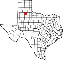 | |
| Town | ||
| Unincorporated communities | ||
This article is issued from
Wikipedia.
The text is licensed under Creative Commons - Attribution - Sharealike.
Additional terms may apply for the media files.