South Oropouche
| South Oropouche | |
|---|---|
 South Oropouche | |
| Coordinates: 10°13′N 061°33′W / 10.217°N 61.550°WCoordinates: 10°13′N 061°33′W / 10.217°N 61.550°W | |
| Country | Trinidad and Tobago |
| Region | Siparia |
| Elevation[1] | 3 m (10 ft) |
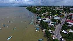
South Oropouche is a community in Trinidad and Tobago. It is at sea level. There is an archaeological site at St John's Road, South Oropouche.[2] Dow Village is in South Oropouche.
References
- ↑ "South Oropouche, Trinidad and Tobago". geoba.se. Retrieved 2017-04-29.
- ↑ All-Inclusive Project Development Services Limited (August 9, 2010). Siparia Regional Corporation: Final Draft Municipal Development Plan (PDF). p. 29. Retrieved June 3, 2012.
This article is issued from
Wikipedia.
The text is licensed under Creative Commons - Attribution - Sharealike.
Additional terms may apply for the media files.