South Keltma River
| South Keltma River | |
|---|---|
 | |
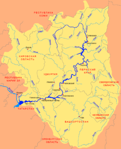 Scheme of the Kama River Basin. | |
| Country | Russia |
| Physical characteristics | |
| Main source | Cherdynsky District |
| River mouth | Kama River |
| Length | 172 km (107 mi) |
| Basin features | |
| River system | Kama River |
| Basin size | 5,270 km2 (2,030 sq mi) |
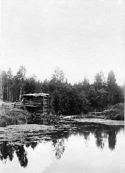
The South Keltma (Russian: Южная Кельтма) is a river in Perm Krai, Russia, a left tributary of the Kama River. It is 172 kilometres (107 mi) long, and its area of drainage basin is 5,270 square kilometres (2,030 sq mi). The source of the river is located in the north of Perm Krai, near the border with the Komi Republic, in Cherdynsky District, to the north of the village of Chepets. The river freezes up in the early November and stays under the ice until the end of April. There are many swamps near the river.
In 1785 – 1822 the Northern Catherine Canal was constructed. It connected the South Keltma with the North Keltma through the Dzhurich River. It was in operation only for 16 years.
Main tributaries:
- Left: Dzhurich, Olkhovka, Verhny Mal, Nizhny Mal;
- Right: Timsher.
External links
Coordinates: 60°28′04″N 55°41′47″E / 60.46778°N 55.69639°E