South Dakota Highway 17
| ||||
|---|---|---|---|---|
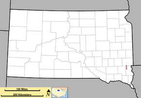 Map of South Dakota with SD 17 in red | ||||
| Route information | ||||
| Defined by SDCL §31-4-140 | ||||
| Maintained by SDDOT | ||||
| Length | 4.041 mi[1] (6.503 km) | |||
| Existed | c. 1929 – present | |||
| Major junctions | ||||
| South end |
| |||
| North end |
| |||
| Location | ||||
| Counties | Lincoln, Minnehaha | |||
| Highway system | ||||
| ||||

South Dakota Highway 17 (SD 17) is a 4.041-mile-long (6.503 km) state highway in the southeastern part of the U.S. state of South Dakota. It connects Lennox with the western edges of Sioux Falls. SD 17 formerly continued south to what is now SD 46 near Centerville.
Route description
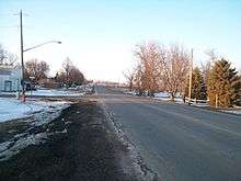
SD 17 begins at an intersection with SD 44 just south of Lennox, in the west-central part of Lincoln County. It travels to the north, on Pine Street, and almost immediately enters the city. It intersects the eastern terminus of Fourth Avenue, which is signed as a "city truck route". North of Second Avenue, the highway crosses over some railroad tracks of BNSF Railway. At an intersection with the eastern terminus of Boynton Avenue and the western terminus of County Road 122 (CR 122; 278th Street), the Pine Street designation ends. Just north of this intersection, the highway leaves Lennox. Between 275th and 274th streets, it crosses over Beaver Creek. North of 271st Street, it passes the Freese Waterfowl Production Area. North of 269th Street, the highway curves to the north-northeast. At an intersection with 268th Street, it enters the south-central part of Minnehaha County.
Just north of this intersection, SD 17 curves back to the north. Wild Water West Adventurepark. It continues through rural areas of the county and reaches its northern terminus, an intersection with SD 42 (265th Street). Here, the roadway continues to the north as 466th Avenue.
History
SD 17 was established by 1929. It originally began at an intersection with what is now SD 46 near Centerville. This segment was decommissioned in the 1990s.
Major intersections
| County | Location | mi[1] | km | Destinations | Notes |
|---|---|---|---|---|---|
| Lincoln | Lennox | 0.000 | 0.000 | Southern terminus | |
| Minnehaha | | 4.041 | 6.503 | Northern terminus; roadway continues as 466th Avenue; former US 16. | |
| 1.000 mi = 1.609 km; 1.000 km = 0.621 mi | |||||
See also

References
- 1 2 "State Highway Log – Mitchell Region" (PDF). South Dakota Department of Transportation. January 2017. p. 10. Retrieved January 23, 2018.
External links
Route map: