South Dakota Highway 130
| ||||
|---|---|---|---|---|
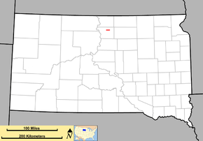 Route of SD 130 (in red) | ||||
| Route information | ||||
| Defined by SDCL §31-4-194 | ||||
| Maintained by SDDOT | ||||
| Length | 7 mi (11 km) | |||
| Existed | 1976 – present | |||
| Major junctions | ||||
| West end |
| |||
| East end |
| |||
| Location | ||||
| Counties | Walworth | |||
| Highway system | ||||
| ||||

South Dakota Highway 130 (SD 130) is a 7-mile-long (11 km) state highway located entirely within Walworth County, in the north-central part of the U.S. state of South Dakota. It connects the city of Selby with the town of Java.
Route description
SD 130 begins at an intersection with the concurrent highways U.S. Route 12 (US 12), US 83, and SD 20 in Selby. It travels in a due eastward direction, with the exception of a northward curve around some railroad tracks through open fields for its entire length, and comes to an end at SD 271 in Java. It utilizes a portion of 130th Street for its path.[1]
History
SD 130 was designated in 1976 as a redesignation of SD 103.[2]
Major intersections
The entire route is in Walworth County.
| Location | mi | km | Destinations | Notes | |
|---|---|---|---|---|---|
| Selby | 0.000 | 0.000 | Western terminus | ||
| Java | Eastern terminus | ||||
| 1.000 mi = 1.609 km; 1.000 km = 0.621 mi | |||||
References
- ↑ Google (2009-12-03). "South Dakota Highway 130" (Map). Google Maps. Google. Retrieved 2009-12-03.
- ↑ "South Dakota Highways Page: Highways 130". Retrieved 2009-12-03.
External links
Route map:
This article is issued from
Wikipedia.
The text is licensed under Creative Commons - Attribution - Sharealike.
Additional terms may apply for the media files.