Soufrière, Saint Lucia
| Soufrière | |
|---|---|
| Town | |
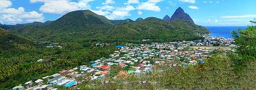 Soufrière and the Pitons | |
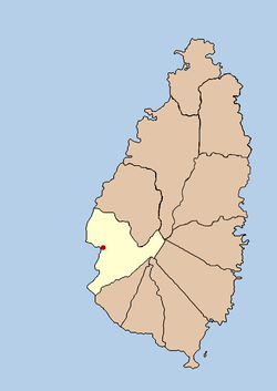 Political map of Saint Lucia showing Soufrière | |
| Coordinates: 13°51′14″N 61°03′33″W / 13.854°N 61.0592°W | |
| Country |
|
| Quarter | Soufrière Quarter |
| Founded | 18th century |
| Founded by | France |
| Named for | The local volcano |
| Government | |
| • Governing body | Soufrière Council |
| Elevation | 5 m (16 ft) |
| Population (2005)[1] | |
| • Total | 7,935 (Soufrière District) |
| Time zone | UTC-4 (Eastern Caribbean Time Zone (ECT)) |
| Area code(s) | 758 |
Soufrière is a town on the West Coast of Saint Lucia, in the eastern Caribbean Sea. The town and the surrounding district has a population of 7,935. It was founded by the French and was the original capital of the island.[2]
History
There were large estates run by plantation owners of French origin and their descendants still live in the area. The French Revolution of 1789 resulted in many Royalists being executed and the slaves freed. However, Napoleon reintroduced slavery when he came to power.
The British invaded St Lucia shortly after, but the slaves and French deserters fought them in a guerrilla campaign until 1803 when they were defeated and St Lucia became a British colony. Also, during that time, Castries became the capital of St Lucia.
Over the years, Soufrière has had to deal with hurricanes in 1780, 1817, 1831, 1898 and 1980, a major fire in 1955 and an earthquake in 1991. Many of these events have had to result in the town being rebuilt several times.
Soufrière inhabitants have included the future Empress of France Joséphine de Beauharnais (who spent much of her childhood in the area), and George Charles (the first Premier of St Lucia). When Queen Elizabeth II visited St Lucia in 1966, she landed at Soufrière rather than Castries.
Today, Soufrière is more dependent on tourism rather than agriculture. The Pitons are just south of the town and there are several attractions in the area. Many of the old estates are still there such as Soufrière Estate, Fond Doux Estate and Rabot Estate.
Tourism
- The Pitons – Gros Piton and Petit Piton are two giant volcanic plugs located south of Soufrière and are a UNESCO World Heritage Site.
- Sulphur Springs – Soufrière is located within the caldera of the dormant Qualibou volcano and the area is geothermally active. Marketed as a drive-through volcano, there are numerous hot springs and fumaroles.
- Soufrière Estate – also known as Diamond Estate, this is an old colonial estate that is home to a botanical garden, sulphur baths and Diamond Falls.[3]
- Fond Doux Estate – a working plantation where cacao is still processed.[4]
- St Lucia's Rainforest – there are several rainforest trails in the area with views, wildlife and waterfalls such as the Enbas Saut Falls.[5]
- Anse Chastanet – a resort with a beach and several trails along the coast.
- Volga Nature Trail - a hiking trail with views of both pitons up close with views of Sugar beach.[6]
In popular culture
Soufrière was the filming location for most of the 1985 film Water, set on the fictional British colony of Cascara.
Gallery for Town of Soufrière
- Soufrière
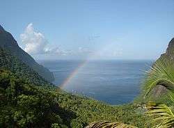 Piton Valley, part of the UNESCO World Heritage Site near Soufrière
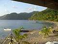 Malgretoute Beach, looking north towards Soufrière
 Catholic Church and Central square, Soufrière, April 2007
 The Pitons at Soufrière
 Soufriere
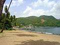 Soufrière Bay
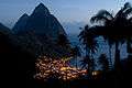 Soufrière at night
See also
Notes
- ↑ Home
- ↑ stlucia.org. "History of Soufrière".
- ↑ Diamond Botanical Gardens. "Diamond Botanical Gardens".
- ↑ Fond Doux Estate. "Fond Doux Estate".
- ↑ St Lucia Ministry of Agriculture, Lands, Forestry and Fisheries. "Homepage".
- ↑ http://www.volgatrail.com
6. Volga Nature Trail www.volgatrail.com
External links
| Wikivoyage has a travel guide for Soufriere. |