Sorrento, British Columbia
| Sorrento | |
|---|---|
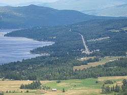 Sorrento and the Trans Canada Highway | |
 Sorrento Location of Sorrento in British Columbia | |
| Coordinates: 50°52′38″N 119°28′14″W / 50.87722°N 119.47056°WCoordinates: 50°52′38″N 119°28′14″W / 50.87722°N 119.47056°W | |
| Country |
|
| Province |
|
| Time zone | UTC-8 (PST) |
| • Summer (DST) | UTC-7 (PDT) |
| Postal codes | V0E 2W0 & V0E 3W0 |
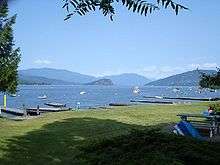
Sorrento is an unincorporated settlement located on the south shore of Shuswap Lake in the Southern Interior of the Canadian province of British Columbia. It is located on the Trans-Canada Highway, and is 16 miles (25 km) northeast of the town of Chase and 28 miles (45 km) northwest of the city of Salmon Arm. Sorrento is in the Columbia-Shuswap C electoral region of the Columbia-Shuswap Regional District.
History
The name of the townsite was changed from Trapper's Landing to Sorrento by resident J.R. Kinghorn, who saw a physical resemblance between Copper Island, which lies across Shuswap Lake, and the Isle of Capri as seen from the city of Sorrento, Italy.[1]
Festivals
Sorrento hosts the Shuswap Lake Festival of the Arts in July, and the Sorrento Bluegrass Festival in late August.[2][3]
Climate
| Climate data for Sorrento | |||||||||||||
|---|---|---|---|---|---|---|---|---|---|---|---|---|---|
| Month | Jan | Feb | Mar | Apr | May | Jun | Jul | Aug | Sep | Oct | Nov | Dec | Year |
| Record high °C (°F) | 13.5 (56.3) |
12 (54) |
16.5 (61.7) |
28.9 (84) |
32.5 (90.5) |
33 (91) |
37 (99) |
35.6 (96.1) |
29.5 (85.1) |
25 (77) |
19.4 (66.9) |
10.5 (50.9) |
37 (99) |
| Average high °C (°F) | −1.9 (28.6) |
0.8 (33.4) |
6.8 (44.2) |
13.3 (55.9) |
18.3 (64.9) |
22 (72) |
25.3 (77.5) |
24.8 (76.6) |
17.9 (64.2) |
10.5 (50.9) |
3.2 (37.8) |
−1.2 (29.8) |
11.6 (52.9) |
| Average low °C (°F) | −6.4 (20.5) |
−4.9 (23.2) |
−1.7 (28.9) |
1.8 (35.2) |
6.3 (43.3) |
10.2 (50.4) |
12.5 (54.5) |
12.5 (54.5) |
8 (46) |
3.3 (37.9) |
−1.4 (29.5) |
−5.1 (22.8) |
2.9 (37.2) |
| Record low °C (°F) | −27.2 (−17) |
−23 (−9) |
−19.4 (−2.9) |
−7.8 (18) |
−1.1 (30) |
2.5 (36.5) |
4.4 (39.9) |
3.5 (38.3) |
−1.5 (29.3) |
−16 (3) |
−27 (−17) |
−25.5 (−13.9) |
−27.2 (−17) |
| Average precipitation mm (inches) | 55 (2.17) |
46.2 (1.819) |
32.9 (1.295) |
28.4 (1.118) |
45.5 (1.791) |
49 (1.93) |
43.4 (1.709) |
39.7 (1.563) |
40.5 (1.594) |
36.9 (1.453) |
59.9 (2.358) |
71.4 (2.811) |
548.7 (21.602) |
| Source: Environment Canada[4] | |||||||||||||
References
- ↑ Information originally provided by: British Columbia Place Names, eds. G.P.V and Helen Akrigg, UBC Press, Vancouver, 1997
- ↑ "Archived copy". Archived from the original on 26 March 2010. Retrieved 14 July 2010.
- ↑ http://www.musicworkshops.ca/
- ↑ Environment Canada—Canadian Climate Normals 1971–2000, accessed 11 July 2009