Solis Planum

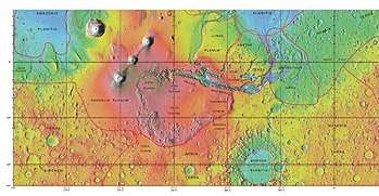
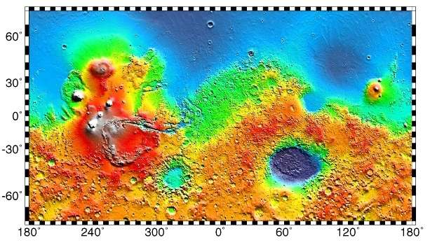
MOLA map showing Solis Planum and other regions. Colors indicate elevations.

Solis Planum is a planum on Mars which has a diameter of 1811.23 km. Its center latitude is 26.4 S and its center longitude is 270.33 E. Solis Planum was named after a classic albedo feature name, and its name was approved in 1973.[1]

Interactive Mars map

Acidalia PlanitiaAcidalia PlanitiaAlba MonsAmazonis PlanitiaAonia TerraArabia TerraArcadia PlanitiaArcadia PlanitiaArgyre PlanitiaElysium MonsElysium PlanitiaHellas PlanitiaHesperia PlanumIsidis PlanitiaLucas PlanumLyot (crater)Noachis TerraOlympus MonsPromethei TerraRudaux (crater)Solis PlanumTempe TerraTerra CimmeriaTerra SabaeaTerra SirenumTharsis MontesUtopia PlanitiaValles MarinerisVastitas BorealisVastitas BorealisMap of Mars
The image above contains clickable linksInteractive imagemap of the global topography of Mars. Hover your mouse to see the names of over 25 prominent geographic features, and click to link to them. Coloring of the base map indicates relative elevations, based on data from the Mars Orbiter Laser Altimeter on NASA's Mars Global Surveyor. Reds and pinks are higher elevation (+3 km to +8 km); yellow is 0 km; greens and blues are lower elevation (down to −8 km). Whites (>+12 km) and browns (>+8 km) are the highest elevations. Axes are latitude and longitude; Poles are not shown.
(See also: Mars Rovers map) (view • discuss)

References

See also

This article is issued from Wikipedia. The text is licensed under Creative Commons - Attribution - Sharealike. Additional terms may apply for the media files.