Soham, New Mexico
| Soham, New Mexico | |
|---|---|
| Unincorporated community | |
 Soham | |
| Coordinates: 35°24′56″N 105°29′39″W / 35.41556°N 105.49417°WCoordinates: 35°24′56″N 105°29′39″W / 35.41556°N 105.49417°W | |
| Country | United States |
| State | New Mexico |
| County | San Miguel |
| Area[1] | |
| • Total | 1.547 sq mi (4.01 km2) |
| • Land | 1.547 sq mi (4.01 km2) |
| • Water | 0 sq mi (0 km2) |
| Elevation | 6,145 ft (1,873 m) |
| Population (2010)[1] | |
| • Total | 210 |
| • Density | 140/sq mi (52/km2) |
| Time zone | UTC-7 (Mountain (MST)) |
| • Summer (DST) | UTC-6 (MDT) |
| Area code(s) | 505 |
| GNIS feature ID | 911190[2] |
Soham is an unincorporated community and census-designated place in San Miguel County, New Mexico, United States. Its population was 210 as of the 2010 census.[1] The community is located near Exit 319 on Interstate 25.
Geography
Soham is located at 35°24′56″N 105°29′39″W / 35.4155984°N 105.4941797°W.[2] According to the U.S. Census Bureau, the community has an area of 1.547 square miles (4.01 km2), all of it land.[1]pecos river runs right though it 14ft at times over 900 miles of river empties into the Rio Grande
References
- 1 2 3 4 "2010 Census Gazetteer Files - Places: New Mexico". U.S. Census Bureau. Retrieved December 31, 2016.
- 1 2 "Soham". Geographic Names Information System. United States Geological Survey.
Municipalities and communities of San Miguel County, New Mexico, United States | ||
|---|---|---|
| City | 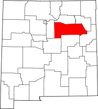 | |
| Villages | ||
| CDPs | ||
| Other unincorporated communities | ||
| Ghost towns | ||
| Footnotes | ‡This populated place also has portions in an adjacent county or counties | |
This article is issued from
Wikipedia.
The text is licensed under Creative Commons - Attribution - Sharealike.
Additional terms may apply for the media files.