Smithville, Georgia
| Smithville, Georgia | |
|---|---|
| City | |
 Smithville Governmental Building and Library | |
 Location in Lee County and the state of Georgia | |
| Coordinates: 31°54′7″N 84°15′19″W / 31.90194°N 84.25528°WCoordinates: 31°54′7″N 84°15′19″W / 31.90194°N 84.25528°W | |
| Country | United States |
| State | Georgia |
| County | Lee |
| Area | |
| • Total | 2.5 sq mi (6.6 km2) |
| • Land | 2.5 sq mi (6.6 km2) |
| • Water | 0 sq mi (0 km2) |
| Elevation | 328 ft (100 m) |
| Population (2010) | |
| • Total | 575 |
| • Estimate (2016)[1] | 587 |
| • Density | 304/sq mi (117.3/km2) |
| Time zone | UTC-5 (Eastern (EST)) |
| • Summer (DST) | UTC-4 (EDT) |
| ZIP code | 31787 |
| Area code(s) | 229 |
| FIPS code | 13-71464[2] |
| GNIS feature ID | 0356540[3] |
Smithville is a city in Lee County, Georgia, United States. The population was 774 at the 2000 census. It is part of the Albany, Georgia Metropolitan Statistical Area. Smithville, a town in the northwest corner of Lee county, is at the junction of two branches of the Central of Georgia railway system. It was incorporated by act of the legislature in 1863. In 1900 it had within its corporate limits a population of 597 and in its entire district 1,954. Near by are two large sawmills, a blacksmith and a woodworking shop, a turpentine distillery, while just across the line in Sumter county is a large grist mill owned in the main by Smithville people, with a daily capacity of 600 bushels of corn. In the town are express and telegraph offices, a money order postoffice with rural free delivery, a bank, a public cotton gin and several prosperous business houses. Large quantities of pears are shipped every season and about 3,000 bales of cotton are handled annually
Geography
Smithville is located at 31°54′7″N 84°15′19″W / 31.90194°N 84.25528°W (31.902073, -84.255336).[4]
According to the United States Census Bureau, the city has a total area of 2.5 square miles (6.5 km2), all land.
Demographics
| Historical population | |||
|---|---|---|---|
| Census | Pop. | %± | |
| 1880 | 320 | — | |
| 1900 | 597 | — | |
| 1910 | 574 | −3.9% | |
| 1920 | 761 | 32.6% | |
| 1930 | 777 | 2.1% | |
| 1940 | 619 | −20.3% | |
| 1950 | 676 | 9.2% | |
| 1960 | 732 | 8.3% | |
| 1970 | 713 | −2.6% | |
| 1980 | 867 | 21.6% | |
| 1990 | 804 | −7.3% | |
| 2000 | 774 | −3.7% | |
| 2010 | 575 | −25.7% | |
| Est. 2016 | 587 | [1] | 2.1% |
| U.S. Decennial Census[5] | |||
As of the census[2] of 2000, there were 774 people, 270 households, and 198 families residing in the city. The population density was 303.6 people per square mile (117.2/km²). There were 305 housing units at an average density of 119.6 per square mile (46.2/km²). The racial makeup of the city was 28.81% White, 70.28% African American, 0.39% from other races, and 0.52% from two or more races. Hispanic or Latino of any race were 1.03% of the population.
There were 270 households out of which 40.4% had children under the age of 18 living with them, 40.7% were married couples living together, 27.8% had a female householder with no husband present, and 26.3% were non-families. 25.6% of all households were made up of individuals and 10.4% had someone living alone who was 65 years of age or older. The average household size was 2.87 and the average family size was 3.44.
In the city, the population was spread out with 33.5% under the age of 18, 10.3% from 18 to 24, 26.0% from 25 to 44, 20.7% from 45 to 64, and 9.6% who were 65 years of age or older. The median age was 30 years. For every 100 females, there were 87.0 males. For every 100 females age 18 and over, there were 86.6 males.
The median income for a household in the city was $31,500, and the median income for a family was $37,083. Males had a median income of $29,375 versus $19,286 for females. The per capita income for the city was $12,193. About 23.3% of families and 27.7% of the population were below the poverty line, including 34.8% of those under age 18 and 34.5% of those age 65 or over.
Education
Public schools are operated by the Lee County School District. Students are zoned to Lee County High School.
Notable people
- Bill McAfee (1907-1958), baseball player and mayor
- William J. Sears (1874-1944), Congressman from Florida
- Bessie Jones (1902-1984), gospel and folk singer
- Hudson Woodbridge (1904-1981), aka Tampa Red, musician in Blues Hall of Fame
Gallery
 Dismuke Public Safety Building, houses the Smithville Police Department
 Smithville Post Office
References
- 1 2 "Population and Housing Unit Estimates". Retrieved June 9, 2017.
- 1 2 "American FactFinder". United States Census Bureau. Retrieved 2008-01-31.
- ↑ "US Board on Geographic Names". United States Geological Survey. 2007-10-25. Retrieved 2008-01-31.
- ↑ "US Gazetteer files: 2010, 2000, and 1990". United States Census Bureau. 2011-02-12. Retrieved 2011-04-23.
- ↑ "Census of Population and Housing". Census.gov. Retrieved June 4, 2015.
External links
- Smithville - State of Georgia
Municipalities and communities of Lee County, Georgia, United States | ||
|---|---|---|
| Cities | 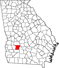 | |
| Unincorporated communities | ||
| Ghost towns | ||