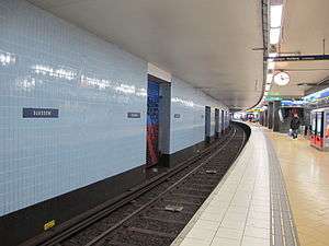
Slussen metro station
Slussen | |||||||||||||||||||||||||||||||
|---|---|---|---|---|---|---|---|---|---|---|---|---|---|---|---|---|---|---|---|---|---|---|---|---|---|---|---|---|---|---|---|
| Stockholm metro station | |||||||||||||||||||||||||||||||
 | |||||||||||||||||||||||||||||||
| Location | Södermalm, Stockholm | ||||||||||||||||||||||||||||||
| Coordinates | 59°19′9″N 18°4′19″E / 59.31917°N 18.07194°ECoordinates: 59°19′9″N 18°4′19″E / 59.31917°N 18.07194°E | ||||||||||||||||||||||||||||||
| Owned by | Storstockholms Lokaltrafik | ||||||||||||||||||||||||||||||
| Other information | |||||||||||||||||||||||||||||||
| Station code | Slu | ||||||||||||||||||||||||||||||
| History | |||||||||||||||||||||||||||||||
| Opened | 1 October 1933 | ||||||||||||||||||||||||||||||
| Rebuilt | 1957 | ||||||||||||||||||||||||||||||
| Services | |||||||||||||||||||||||||||||||
| |||||||||||||||||||||||||||||||
| Location | |||||||||||||||||||||||||||||||
|
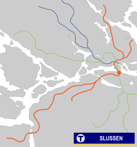 | |||||||||||||||||||||||||||||||

Slussen is a station of the Stockholm metro, located in Slussenområdet in the district of Södermalm. The station is served by the red and green lines. Originally opened in 1933 as an underground tram stop, in 1950 it became the terminal of the first metro line running south to Hökarängen, it was again rebuilt in 1957 when the line north to Hötorget was opened.[1]
Just outside the northern entrance to the metro station, there is a bus terminal for buses to the Nacka and Värmdö municipalities. The terminus for the Saltsjöbanan railway was also located here, but it was moved to Henriksdal in 2016 due to the reconstruction of Slussen. Traffic will resume when the reconstruction is complete, possibly in 2026.[2]
In November 2017 an art exhibiition by Liv Strömquist at the metro station sparked a debate about the appropriateness of showing depictions of menstruation to children.[3]
References
- ↑ http://www.kynerd.net/Tunnelbanan/Slussen.html
- ↑ Spetz, Lennart (13 June 2016). "Sista färden till Slussen / Tio år tills Saltsjöbanan når Slussen igen". Nacka Värmdö Posten (in Swedish) (2016–24). p. 8. Retrieved 21 January 2017.
- ↑ Hunt, Elle (2017-11-02). "'Enjoy menstruation, even on the subway': Stockholm art sparks row". the Guardian. Retrieved 2018-07-21.
External links