Skjold, Rogaland
| Skjold | |
|---|---|
| Village | |
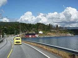 View of the highway passing near the village | |
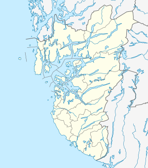 Skjold Location in Rogaland county  Skjold Skjold (Norway) | |
| Coordinates: 59°30′09″N 05°35′12″E / 59.50250°N 5.58667°ECoordinates: 59°30′09″N 05°35′12″E / 59.50250°N 5.58667°E | |
| Country | Norway |
| Region | Western Norway |
| County | Rogaland |
| District | Haugaland |
| Municipality | Vindafjord |
| Area[1] | |
| • Total | 0.92 km2 (0.36 sq mi) |
| Elevation[2] | 15 m (49 ft) |
| Population (2014)[1] | |
| • Total | 759 |
| • Density | 825/km2 (2,140/sq mi) |
| Time zone | UTC+01:00 (CET) |
| • Summer (DST) | UTC+02:00 (CEST) |
| Post Code | 5574 Skjold |
Skjold is a village in Vindafjord municipality in Rogaland county, Norway. The village is located at the northern end of the Skjoldafjorden, along the European route E134 highway, about 25 kilometres (16 mi) northeast of the town of Haugesund. Skjold Church is located in the village. The village was the administrative centre of the old municipality of Skjold which existed from 1838 until 1965.
The 0.92-square-kilometre (230-acre) village has a population (2014) of 759, giving the village a population density of 825 inhabitants per square kilometre (2,140/sq mi).[1]
References
- 1 2 3 Statistisk sentralbyrå (1 January 2014). "Urban settlements. Population and area, by municipality".
- ↑ "Skjold, Vindafjord (Rogaland)" (in Norwegian). yr.no. Retrieved 2015-07-19.
This article is issued from
Wikipedia.
The text is licensed under Creative Commons - Attribution - Sharealike.
Additional terms may apply for the media files.