Skjaldbreiður
| Skjaldbreiður | |
|---|---|
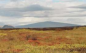 Skjaldbreiður as seen from Þingvellir | |
| Highest point | |
| Elevation | 1,060 m (3,480 ft) |
| Coordinates | 64°24′36″N 20°45′44″W / 64.41000°N 20.76222°WCoordinates: 64°24′36″N 20°45′44″W / 64.41000°N 20.76222°W |
| Naming | |
| Translation | broad shield (Icelandic) |
| Geography | |
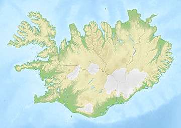 Skjaldbreiður Iceland | |
| Geology | |
| Age of rock | 9,000 years |
| Mountain type | shield volcano |
Skjaldbreiður, meaning the broad shield in Icelandic, is an Icelandic lava shield formed in one huge and protracted eruption roughly 9,000 years ago. The extensive lava fields which were produced by this eruption, flowed southwards, and formed the basin of Þingvallavatn, Iceland's largest lake, and Þingvellir, the "Parliament Plains" where the Icelandic national assembly, the Alþing was founded in 930.
The volcano summit is at 1,060 metres, and its crater measures roughly 300 metres in diameter.
Straddling the Mid-Atlantic ridge, the lava fields from Skjaldbreiður have been torn and twisted over the millennia, forming a multitude of fissures and rifts inside the Þingvellir National Park, the best known of which are Silfra, Almannagjá, Hrafnagjá and Flosagjá.
Gallery
 Skjaldbreiður crater in snow.
References
- Scarth, Alwyn; Tanguy, Jean-Claude (2001). Volcanoes of Europe. Oxford University Press. pp. 243 pp. ISBN 0-19-521754-3.
- Thordarson, Thor; Hoskuldsson, Armann (2002). Iceland (Classic Geology in Europe 3). Terra Publishing. pp. 208 pp. ISBN 1-903544-06-8.