Skeeby
| Skeeby | |
|---|---|
 Skeeby | |
 Skeeby Skeeby shown within North Yorkshire | |
| Population | 357 (2011 census)[1] |
| OS grid reference | NZ200025 |
| District | |
| Shire county | |
| Region | |
| Country | England |
| Sovereign state | United Kingdom |
| Post town | RICHMOND |
| Postcode district | DL10 |
| Dialling code | 01748 |
| Police | North Yorkshire |
| Fire | North Yorkshire |
| Ambulance | Yorkshire |
| EU Parliament | Yorkshire and the Humber |
| UK Parliament | |
Skeeby is a village and civil parish about 18 miles (29 km) north-west of the county town of Northallerton in the Richmondshire district of North Yorkshire, England.
History

Skeeby was recorded as Schirebi in the Domesday Book – the description being: "In Skeeby there are six carucates and there could be four ploughs there".[2] In other early references to the village it is known as Schireby in the 11th century, Scythebi and Scideby in the 12th century, Schideby, Skitteby and Skytheby[3] in the 13th and 14th centuries and finally Skeitby or Skeby in the 16th century.[4]
The origins of Skeeby Bridge, over Gilling Beck, date from the early 14th century, the existing structure being a 17th-century Grade II listed structure[5] that was widened by John Carr in 1781/2.[6] The earliest remaining buildings in the village date from the 17th and 18th centuries. In 1870-72, John Marius Wilson's Imperial Gazetteer of England and Wales described Skeeby: SKEEBY, a township in Easby parish, N. R. Yorkshire; 2½ miles ENE of Richmond. Acres, 770. Real property, £1,234. Pop., 180. Houses, 42.[7]
Governance
The village lies within the Richmond (Yorks) parliamentary constituency, which has been represented since 1989 by Conservative William Hague. It also lies within the Richmondshire North electoral division of North Yorkshire County Council and the Middleton Tyas ward of Richmondshire District Council.[8]
Geography
Skeeby is located on the A6108 road, the main road between Richmond and Scotch Corner, linking with the A66 and A1. The nearest settlements to Skeeby are Richmond, 2.3 miles (3.7 km) to the west and Gilling West 2.8 miles (4.5 km). A small beck flows through the village, as well as Gilling Beck which becomes Skeeby Beck and flows under Skeeby Bridge, as a consequence the main road and farmland surrounding Gilling Beck are prone to flooding.[9] Skeeby Beck flows into the River Swale just above Brompton-on-Swale.
Demography
| Population [10][11][1] | ||||||||||
|---|---|---|---|---|---|---|---|---|---|---|
| Year | 1881 | 1891 | 1901 | 1911 | 1921 | 1931 | 1951 | 1961 | 2001 | 2011 |
| Total | 159 | 148 | 146 | 126 | 122 | 158 | 195 | 253 | 379 | 357 |
2011 census
The 2011 UK census showed that the population was split 44.3% male to 55.7% female. The religious constituency was made of 75.1% Christian, 0.8% Buddhist, 0.3% Muslim, 0.3% Other religions and the rest stating no religion or not stating at all. The ethnic make-up was 97.5% White British, 0.6% British Asian and 0.8% each White Other . There were 188 dwellings.[1]
Community and culture
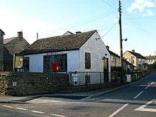
Education for the village children is provided by three primary schools in nearby Richmond (CE, Methodist and St Mary's). Pupils then receive secondary education at Richmond School & Sixth Form College.[12] The public house, the Traveller's Rest, was closed in 2008 and since then there have been many negotiations by the community-founded "Skeeby Community Pub Society" in order to purchase the pub back for the villagers. As of 2017 the pub is still boarded up and awaiting a decision on its future.[13] The village shop, known as "Skeeby Stores" and the post office are also now no longer in business, the store premises have since been refurbished, awaiting new ownership, while the old post office is a cottage.
Religion

The church, dedicated to St Agatha was built in 1840, being used as a second chapel of ease to the larger and older church of St Agatha, at nearby Easby Abbey. It served both as a church and a school, until the school moved across the road during Victorian times, into what is now a residential abode.[14] There was also a Wesleyan chapel, which has now also been converted into a residence.
References
- 1 2 3 UK Census (2011). "Local Area Report – Skeeby Parish (1170217188)". Nomis. Office for National Statistics. Retrieved 28 April 2018.
- ↑ Powell-Smith, Anna. "Skeeby | Domesday Book". opendomesday.org. Retrieved 10 April 2017.
- ↑ Ekwall, Eilert (1960). The concise Oxford dictionary of English place-names (4 ed.). Oxford: Clarendon Press. p. 424. ISBN 0-19-869103-3.
- ↑ Speight, Harry (1897). Romantic Richmondshire (1 ed.). London: Elliot Stock. p. 69. OCLC 500106879.
- ↑ Historic England. "Skeeby Bridge (Grade II) (1131550)". National Heritage List for England. Retrieved 10 April 2017.
- ↑ "The History of the Local Area | The Old Mill Centre". www.oldmillcentre.co.uk. Retrieved 10 April 2017.
- ↑ "History of Skeeby, in Richmondshire and North Riding | Map and description". www.visionofbritain.org.uk. Retrieved 10 April 2017.
- ↑ Ordnance Survey Open Viewer
- ↑ "Flooding in Middleton One Row and Skeeby". The Northern Echo. 24 September 2012. Retrieved 12 June 2013.
- ↑ "Population at Censuses". Vision of Britain. 2009. Retrieved 12 June 2013.
- ↑ "2001 UK Census". Office for National Statistics. 2002. Retrieved 12 June 2013.
- ↑ "Admission arrangements for the Northallerton area". Secondary school admissions. North Yorkshire County Council. Archived from the original on 29 September 2011. Retrieved 12 June 2013.
- ↑ "The Skeeby Community Pub Society Limited". The Skeeby Community Pub Society Limited. Retrieved 10 April 2017.
- ↑ "Church History". St Agatha at Skeeby. Parish of Easby with Skeeby, Brompton on Swale and Bolton on Swale. Retrieved 12 June 2013.
External links
![]()
- The ancient parish of Easby: historical and genealogical information at GENUKI (Skeeby was in this parish).