Skapiškis
| Skapiškis | |
|---|---|
| Town | |
 | |
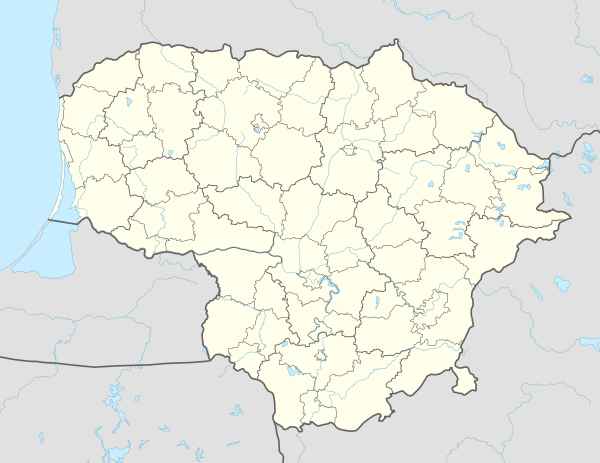 Skapiškis Location of Skapiškis | |
| Coordinates: 55°53′30″N 25°12′0″E / 55.89167°N 25.20000°ECoordinates: 55°53′30″N 25°12′0″E / 55.89167°N 25.20000°E | |
| Country |
|
| Ethnographic region | Aukštaitija |
| County |
|
| Municipality | Kupiškis district municipality |
| Elderate | Skapiškis elderate |
| Capital of | Skapiškis elderate |
| First mentioned | 1492 |
| Granted city rights | 1633 |
| Population (2011) | |
| • Total | 403 |
| Time zone | UTC+2 (EET) |
| • Summer (DST) | UTC+3 (EEST) |
Skapiškis is a town in the Kupiškis district municipality, Lithuania. It is situated on the shores of Lake Mituva and near the road and railway connecting Panevėžys with Daugavpils. According to the 2011 census, it had population of 403.[1]
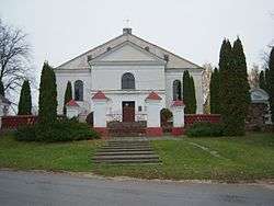
The first church, named after Saint Hyacinth, was built in 1519.[2] In 1752 the Dominican monks established a monastery. The monks opened a parish school, which had 40 students in 1805. Both the monastery and the school were closed by tsarist authorities after the Uprising of 1831.[3] After the construction of the Panevėžys–Daugavpils railway, the settlement grew into a trading town. It had 1,184 inhabitants in 1897.[3] It declined sharply after World War II.
References
- ↑ "2011 census". Statistikos Departamentas (Lithuania). Retrieved August 13, 2017.
- ↑ "Skapiškio Šv. Hiacinto (Jackaus) parapija" (in Lithuanian). Panevėžio vyskupijos kurija. Retrieved 2009-09-06.
- 1 2 Simas Sužiedėlis, ed. (1970–1978). "Skapiškis". Encyclopedia Lituanica. V. Boston, Massachusetts: Juozas Kapočius. p. 198. LCC 74-114275.

This article is issued from
Wikipedia.
The text is licensed under Creative Commons - Attribution - Sharealike.
Additional terms may apply for the media files.