Sjøholt
| Sjøholt | |
|---|---|
| Village | |
|
View of Sjøholt, looking west | |
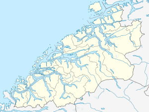
 Sjøholt Location in Møre og Romsdal  Sjøholt Sjøholt (Norway) | |
| Coordinates: 62°29′01″N 06°48′38″E / 62.48361°N 6.81056°ECoordinates: 62°29′01″N 06°48′38″E / 62.48361°N 6.81056°E | |
| Country | Norway |
| Region | Western Norway |
| County | Møre og Romsdal |
| District | Sunnmøre |
| Municipality | Ørskog |
| Area[1] | |
| • Total | 1.37 km2 (0.53 sq mi) |
| Elevation[2] | 3 m (10 ft) |
| Population (2013)[1] | |
| • Total | 1,436 |
| • Density | 1,048/km2 (2,710/sq mi) |
| Time zone | UTC+01:00 (CET) |
| • Summer (DST) | UTC+02:00 (CEST) |
| Post Code | 6240 Ørskog |
Sjøholt is the administrative centre of Ørskog Municipality in Møre og Romsdal county, Norway. The village is located along the northern shore of the Storfjorden, about 10 kilometres (6.2 mi) east of the village of Skodje. The village of Stordal is located about 18 kilometres (11 mi) to the south, through several tunnels. Sjøholt is located roughly halfway between the towns of Ålesund and Molde, along European route E39 and European route E136.
The 1.37-square-kilometre (340-acre) village has a population (2013) of 1,436; giving the village a population density of 1,048 inhabitants per square kilometre (2,710/sq mi).[1] The village is home to furniture, wood, and plastics industries. The regional high school and Ørskog Church are also located here.[3] The newspaper Bygdebladet is published in Sjøholt.[4][5]
References
- 1 2 3 Statistisk sentralbyrå (1 January 2013). "Urban settlements. Population and area, by municipality".
- ↑ "Sjøholt" (in Norwegian). yr.no. Retrieved 2010-10-16.
- ↑ Store norske leksikon. "Sjøholt" (in Norwegian). Retrieved 2010-10-16.
- ↑ Hatlem, Bjørn Arild. 2015. Bygdebladet har fått ny redaktør. Sunnmøringen (January 14).
- ↑ Hatlem, Bjørn Arild. 2015. Bygdebladet har fått ny redaktør. Sunnmøringen (January 14).