Siriyari
| Siriyari सिरीयारी | |
|---|---|
| Village | |
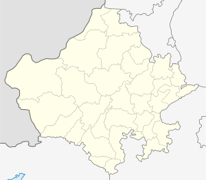
 Siriyari Location in Rajasthan, India  Siriyari Siriyari (India) | |
| Coordinates: 25°40′24″N 73°48′30″E / 25.673261°N 73.808352°ECoordinates: 25°40′24″N 73°48′30″E / 25.673261°N 73.808352°E | |
| Country |
|
| State | Rajasthan |
| District | Pali |
| Government | |
| • Body | Gram Panchayat |
| Population (2001) | |
| • Total | 13,500 |
| Languages | |
| • Official | Hindi |
| Time zone | UTC+5:30 (IST) |
| PIN | 306027 |
| Telephone code | 02935 |
| Vehicle registration | RJ-22 |
| Sex ratio | 993 ♂/♀ |
Siriyari is a small town situated in State of Rajasthan, District Pali. It is situated on State Highway 62 connecting Sojat, Sojat Road, Sireeyari, Phulad, Jojawar. This village has a Police station connected to near by villages via Chowkis thereof.
It is well famous as death place of Acharya Bhikshu (1726–1803) who was the founder and first spiritual head of the Svetambar Terapanth sect of Jainism. There is a famous temple on his name, which has been a new landmark.[1]
History
This is a leading estate established by the Kumpawat clan of Rathores in 1635. Thakur Mahesh Das, son of Rao Kumpa of Marwar, was father of a son, Thakur Aas Karan, who was granted the estate of Digai in 1616. His eldest son, Thakur Amar Singh succeeded in Digai and won Siriyari from the Solanki Rajputs in a battle in 1635.[2]
Connectivity
District Headquarter: Pali (74 km) Nearest Railway Station: Sojat Road (24 km) and Marwar Junction Buses are available all time from Sojat Road which is best spot for getting via Roads.
References
- ↑ "Bhikshu".
- ↑ History. "Rajput History".
- Shashi, S. S. Encyclopaedia Indica: India, Pakistan, Bangladesh. Origin and development of Indus civilization (Volume 1). Anmol Publications. ISBN 81-7041-859-3.
- Singh, Narendra (2001). "Acahrya Bhikshu and Terapanth". Encyclopaedia of Jainism. Anmol Publications. ISBN 81-261-0691-3.