Sirindhorn Dam
| Sirindhorn Dam | |
|---|---|
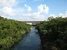 Downstream face of dam | |
 Location of Sirindhorn Dam in Thailand | |
| Official name | Sirindhorn Dam |
| Country | Thailand |
| Location | Sirindhorn, Ubon Ratchathani |
| Coordinates | 15°12′22.82″N 105°25′44.96″E / 15.2063389°N 105.4291556°ECoordinates: 15°12′22.82″N 105°25′44.96″E / 15.2063389°N 105.4291556°E |
| Construction began | 1968 |
| Opening date | 1971 |
| Owner(s) | Electricity Generating Authority of Thailand |
| Dam and spillways | |
| Type of dam | Earth core rockfill dam |
| Impounds | Dom Noi River |
| Height | 42 m (138 ft) |
| Length | 940 m (3,080 ft) |
| Reservoir | |
| Creates | Sirindhorn Reservoir |
| Total capacity | 1,966,000,000 m3 (1,593,862 acre⋅ft) |
| Catchment area | 2,097 km2 (810 sq mi) |
| Surface area | 288 km2 (111 sq mi)[1] |
| Maximum length | 43 km (27 mi) |
| Maximum water depth | Average: 5.1 m (17 ft)[2] |
| Power Station | |
| Operator(s) | Electricity Generating Authority of Thailand |
| Installed capacity | 36 MW |
| Annual generation | 90 GWh |
The Sirindhorn Dam is located in Sirindhorn District, Ubon Ratchatani, Thailand. It impounds the Lam Dom Noi River, and its reservoir is the province's largest water resource. The dam was commissioned in 1971 to serve as a hydropower facility as well as to supply irrigation water. The dam was named after Princess Royal Sirindhorn. All of the electricity generated by the dam is destined for domestic markets. The dam was constructed and is owned and operated by the Electricity Generating Authority of Thailand and is located in the Mekong River Basin, just upstream from the controversial Pak Mun Dam.
Some 2,000 villagers were resettled to make way for the dam's reservoir. Many claim they did not receive adequate compensation for the loss of their livelihood and only received compensation for 80% of their land. Furthermore, they claim that the land in the resettlement village is of poor quality and few crops can be grown, and that a proposed irrigation canal was never built.[3]
The reservoir and dam power the Sirindhorn Hydropower Plant, which has an installed capacity of 3 units of 12,000 kilowatts each and annual energy production of 90 GWh.[4]
There is a park near the dam headquarters and a restaurant and bungalows for visitors.[5] There is a golf course in this area also, at the north end of the lake.[6]
See also
References
- ↑ "Renovation of Small Hydropower Plants by Hydropower Construction Division in 2005". Hydro Power Construction Division. Archived from the original on 10 July 2011. Retrieved 12 March 2013.
- ↑ "Variations and patterns of fish yields in large reservoirs in Thailand" (PDF). National Institute for Environmental Studies (Japan). 17 January 2011. Archived from the original (PDF) on 24 January 2013. Retrieved 12 March 2013.
- ↑ Imhof, Aviva. "DAM-BUSTING - anti-dam protests in Thailand". The Ecologist. Archived from the original on 14 July 2012. Retrieved 6 March 2011.
- ↑ "Renovation of Small Hydropower Plants". Electricity Generating Authority of Thailand. Archived from the original on 10 July 2011. Retrieved 12 March 2013.
- ↑ Thailand (Eyewitness Travel Guides) (1st American ed.). DK Publishing, Inc. 1997. p. 289. ISBN 0-7894-1949-1.
- ↑ Sirindhorn Reservoir (Map). Google Maps. Retrieved 12 March 2013.
External links
| Wikimedia Commons has media related to Mekong. |
- CPWF-Mekong
- Hydropower Construction Division, Electricity Generating Authority of Thailand
- Department of Energy Promotion and Development (EPD), Ministry of Energy and Mines (Lao PDR)
- Department of Water Resources (Thailand)
- Greater Mekong Sub-region Social Studies Center -
- Thailand National Mekong Committee