Sir el Gharbiyeh
| Sir el Gharbiyeh سير الغربية | |
|---|---|
| Village | |
 Sir el Gharbiyeh Location in Lebanon | |
| Coordinates: 33°19′12.24″N 35°21′50.8″E / 33.3200667°N 35.364111°E | |
| Grid position | 114/154 L |
| Country |
|
| Governorate | Nabatieh Governorate |
| District | Nabatieh District |
| Time zone | UTC+2 (EET) |
| • Summer (DST) | +3 |
| Area code(s) | +961 - (07 - South Lebanon) |
Sir el Gharbiyeh (سير الغربية) is a village just north of the Litani River, in the Nabatieh District in southern Lebanon.
History
In the 1596 tax records, it was named as a village, Sir, in the Ottoman nahiya (subdistrict) of Sagif under the liwa' (district) of Safad, with a population of 10 households, all Muslim. The villagers paid a fixed tax-rate of 25% on agricultural products, such as wheat, barley, olive trees, goats and beehives, in addition to "occasional revenues"; a total of 2,000 akçe.[1][2]
References
Bibliography
- Hütteroth, Wolf-Dieter; Abdulfattah, Kamal (1977). Historical Geography of Palestine, Transjordan and Southern Syria in the Late 16th Century. Erlanger Geographische Arbeiten, Sonderband 5. Erlangen, Germany: Vorstand der Fränkischen Geographischen Gesellschaft. ISBN 3-920405-41-2.
- Rhode, Harold (1979). Administration and Population of the Sancak of Safed in the Sixteenth Century. Columbia University.
External links
- Sir el Gharbiyeh, Localiban
| Capital | 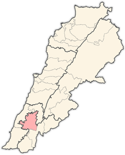 | |
|---|---|---|
| Towns and villages |
| |
| Other | ||
This article is issued from
Wikipedia.
The text is licensed under Creative Commons - Attribution - Sharealike.
Additional terms may apply for the media files.