Sinyi Elementary School MRT station
Sinyi Elementary School 信義國小 | |||||||||||
|---|---|---|---|---|---|---|---|---|---|---|---|
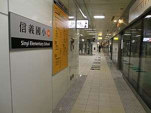 Platform of Sinyi Elementary School station | |||||||||||
| Location |
Sinsing, Kaohsiung Taiwan | ||||||||||
| Operated by | |||||||||||
| Line(s) |
| ||||||||||
| Platforms | 1 island platform | ||||||||||
| Connections | Bus stop | ||||||||||
| Construction | |||||||||||
| Structure type | Underground | ||||||||||
| Disabled access | Yes | ||||||||||
| History | |||||||||||
| Opened | 2008-09-14 | ||||||||||
| Traffic | |||||||||||
| Passengers | 3,147 daily (Jan. 2011)[1] | ||||||||||
| Services | |||||||||||
|
| |||||||||||
| Sinyi Elementary School MRT station | |||||||||||||
| Traditional Chinese | 信義國小車站 | ||||||||||||
|---|---|---|---|---|---|---|---|---|---|---|---|---|---|
| Simplified Chinese | 信义国小车站 | ||||||||||||
| |||||||||||||
Sinyi Elementary School is a station on the Orange line of Kaohsiung MRT in Sinsing District, Kaohsiung, Taiwan.
Station overview
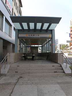
Exit 4 of Sinyi Elementary School station
The station is a two-level, underground station with an island platform and five exits.[2] The station is 215 meters long and is located at the intersection of Jhongjheng 2nd Rd. and Minzu 2nd Rd.[3]
Station layout
| Street Level | Entrance/Exit | Entrance/Exit |
| B1 | Concourse | Lobby, information desk, automatic ticket machines, one-way faregates, restrooms (near exit 1) |
| B2 | Platform 1 | ← KMRT Orange Line toward Sizihwan (Formosa Boulevard) |
| Island platform, doors will open on the left | ||
| Platform 2 | → KMRT Orange Line toward Daliao (Cultural Center) → | |
Exits
- Exit 1: Sinyi Elementary School (west), Jintian Rd., Sinsing District Administrative Center

- Exit 2: Sinyi Elementary School (east), Kaifeng Rd.
- Exit 3: Jintian Rd.,
- Exit 4: Minzu 2nd Rd., Dingsin Park
- Exit 5: Minzu 2nd Rd., Cathay Jhongjheng Building
Around the station
- Sinyi Elementary School
- Kaohsiung City Government Fire Department
- The Lees Hotel
- Talk Club Marketing Service / TC English Ltd.
- Woman Service Center of Social Affairs Bureau
- Cathay Jhongjheng Building
- Vepsi Tower
- Hong Fa Temple
- Water Tower Park
References
| Wikimedia Commons has media related to Sinyi Elementary School Station. |
- ↑ "統計資訊 > 統計月報". Transportation Bureau, Kaohsiung City Government. Retrieved 2011-02-15.
- ↑ "信義國小站". 高雄捷運公司. Retrieved 2010-07-05.
- ↑ "信義國小站週邊地圖". 高雄捷運公司. Archived from the original on 2007-12-04. Retrieved 2010-07-05.
Coordinates: 22°37′51″N 120°18′40″E / 22.63083°N 120.31111°E
This article is issued from
Wikipedia.
The text is licensed under Creative Commons - Attribution - Sharealike.
Additional terms may apply for the media files.