Simpson, Milton Keynes
| Simpson | |
|---|---|
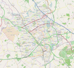 Simpson Mapping © OpenStreetMap 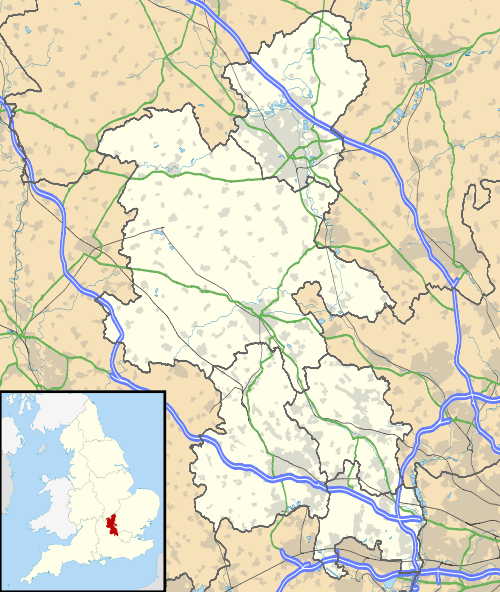 Simpson Simpson shown within Buckinghamshire | |
| Population | 1,142 (parish: 2011)[1] |
| OS grid reference | SP883362 |
| Civil parish | |
| Unitary authority | |
| Ceremonial county | |
| Region | |
| Country | England |
| Sovereign state | United Kingdom |
| Post town | MILTON KEYNES |
| Postcode district | MK6 |
| Dialling code | 01908 |
| Police | Thames Valley |
| Fire | Buckinghamshire |
| Ambulance | South Central |
| EU Parliament | South East England |
| UK Parliament | |
Simpson is a village in Milton Keynes. It was one of the villages of Buckinghamshire that was included in the "New City" in 1967. It is located south of the centre, just north of Fenny Stratford.
Simpson is now part of the civil parish of Simpson and Ashland, which also includes Ashland and West Ashland.[2]
History
The village name is derived from Old English, and means 'Sigewine's farm'. It was recorded in the Domesday Book of 1086 as Siwinestone.[3] It is the only parish of this name in the United Kingdom, (although there is a hamlet called Simpson in the parish of Nolton and Roche in Wales).
In the mid 19th century the village was described[4] as "in appearance, one of the most wretched of many miserable villages in the county". According to Sheahan, "during the wintertime the main road was generally impassable, without wading through water three feet deep, for a distance of about 200 yards. " he goes on to state that "chiefly through the exertions of Mr. C. Warren, the road has been raised by 3 and a half feet." Charles Warren was the owner of Simpson House and was a substantial landowner and contractor. It would have been in his interest to alleviate flooding in the village, although there is no documentary evidence that he was directly involved in the improvement works.
Simpson was an ancient parish, which included part of Fenny Stratford.[3] It became a civil parish in 1866, but in 1934 the civil parish was abolished and absorbed by Bletchley Urban District,[5] which itself was abolished in 1974 to become part of the Borough of Milton Keynes.
References
| Wikimedia Commons has media related to Simpson, Buckinghamshire. |
- ↑ UK Census (2011). "Local Area Report – Simpson and Ashland Parish (1170212030)". Nomis. Office for National Statistics. Retrieved 9 February 2018.
- ↑ Simpson and Ashland Parish Council website
- 1 2 'Parishes : Simpson' – Victoria History of the Counties of England, A History of the County of Buckingham: Volume 4 (1927), pp. 458-462. Date accessed: 30 January 2012.
- ↑ Sheahan, James Joseph, "History and Topography of Buckinghamshire", published in 1862
- ↑ Vision of Britain website