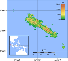
Simeulue
 | |
| Geography | |
|---|---|
| Location | South East Asia |
| Coordinates | 2°35′N 96°05′E / 2.583°N 96.083°ECoordinates: 2°35′N 96°05′E / 2.583°N 96.083°E |
| Area | 2,310 km2 (890 sq mi) |
| Highest elevation | 567 m (1,860 ft) |
| Highest point | unnamed |
| Administration | |
|
Indonesia | |
| Province | Aceh |
| Regency | Simeulue Regency |
| Largest settlement | Sinabang |
| Demographics | |
| Population | 82,100 (2007 census) |
| Pop. density | 35.5 /km2 (91.9 /sq mi) |
Simeulue is an island of Indonesia, 150 kilometres (93 mi) off the west coast of Sumatra. Its capital is Sinabang.
Simeulue was once a part of West Aceh Regency but was split off in 1999 and became a separate Simeulue Regency.
Demographics
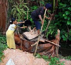
From the ethnic point of view the inhabitants of Simeulue are similar to the people of neighboring Nias Island. Two languages and a number of dialects are spoken on the island: Devayan and Sigulai, which are different from the languages spoken in the north of Sumatra.[1] The majority of the island's population is Muslim.
2004 Indian Ocean earthquake
Simeulue was close to the epicenter of the 9.3 magnitude 26 December 2004 earthquake.
On 28 March 2005, an 8.7 magnitude earthquake struck with its epicenter just off the south end of the island.[2] During the earthquake, Simeulue rose at least 2 metres (6 ft) on the western coast; this left the flat top of its coral reefs above high tide. On the east coast, the land was submerged, with seawater flooding fields and settlements.[3]
Smong
Although Simeulue Island was only 60 kilometers from the epicenter, while Banda Aceh - the city that was hit the most by the tsunami - was about 250 kilometers, only six residents died while the remaining 70,000 persons were safe, due to local wisdom called 'smong'; this dictated that after an earthquake, if the tide suddenly receded, people should evacuate to higher ground as soon as possible.[4][5][6][7]
Tourism
Over the past 10 years Simeulue has become a growingly popular surf destination. The SW facing portion of the island holds multiple world class waves and a handful of surf resorts have popped up in recent years. As surfers have continued to explore throughout Indonesia over the past 40 years since traveling surfers first arrived to Bali, surfing has expanded to more and more of Indonesia's many islands. Simeulue has been one of the last of these islands with quality waves to catch on, and still remains as one of surfing last frontiers.
See also
References
- ↑ BPS Kabupaten Simeulue (2003). Simeulue Dalam Angka 2012. BadanPusatStatistik.Com. ISBN 0-0100-0021-6.
- ↑ Gibbons, Helen (April 2005) "Second Tsunami Causes Damage in Indonesia—USGS Scientists Post Observations on the World Wide Web" United States Geological Survey
- ↑ Saved by tsunami folklore, BBC News From Our Correspondent, 10 March 2007
- ↑ "The analysis of the development of the Smong story on the 1907 and 2004 Indian Ocean tsunamis in strengthening the Simeulue island community's resilience". International Journal of Disaster Risk Reduction. 29: 13–23. 2018-08-01. doi:10.1016/j.ijdrr.2017.07.015. ISSN 2212-4209.
- ↑ McAdoo, Brian G.; Dengler, Lori; Prasetya, Gegar; Titov, Vasily (2006-06). "Smong: How an Oral History Saved Thousands on Indonesia's Simeulue Island during the December 2004 and March 2005 Tsunamis". Earthquake Spectra. 22 (S3): 661–669. doi:10.1193/1.2204966. ISSN 8755-2930. Check date values in:
|date=(help) - ↑ Suciani, A.; Islami, Z. R.; Zainal, S.; Sofiyan; Bukhari (2018). ""Smong" as local wisdom for disaster risk reduction". IOP Conference Series: Earth and Environmental Science. 148 (1): 012005. doi:10.1088/1755-1315/148/1/012005. ISSN 1755-1315.
- ↑ Pasotti, Jacopo (2014-12-10). "Smong: The Tsunami Story". Jacopo Pasotti. Retrieved 2018-07-29.
External links
