Simón Planas Municipality
| Simón Planas Municipality Municipio Simón Planas | |||
|---|---|---|---|
| Municipality | |||
| |||
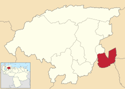 Location in Lara | |||
.svg.png) Simón Planas Municipality Location in Venezuela | |||
| Coordinates: 9°53′43″N 69°02′58″W / 9.895358°N 69.049424°WCoordinates: 9°53′43″N 69°02′58″W / 9.895358°N 69.049424°W | |||
| Country |
| ||
| State | Lara | ||
| Municipal seat | Sarare | ||
| Government | |||
| • Mayor | Fermín Marín (PSUV) | ||
| Area | |||
| • Total | 808 km2 (312 sq mi) | ||
| Population (2007) | |||
| • Total | 35,170 | ||
| • Density | 44/km2 (110/sq mi) | ||
| Time zone | UTC−04:00 (VET) | ||
| Area code(s) | 0251 | ||
| Website | Official website | ||


The Simón Planas Municipality is one of the nine municipalities (municipios) that makes up the Venezuelan state of Lara and, according to a 2007 population estimate by the National Institute of Statistics of Venezuela, the municipality has a population of 35,170.[1] The town of Sarare is the shire town of the Simón Planas Municipality.[2]
History
The municipality was officially founded in 1990.
Demographics
The Simón Planas Municipality, according to a 2007 population estimate by the National Institute of Statistics of Venezuela, has a population of 35,170 (up from 29,521 in 2000). This amounts to 2% of the state's population.[3] The municipality's population density is 43.53 inhabitants per square kilometre (112.7/sq mi).[4]
Government
The mayor of the Simón Planas Municipality is Naudy Jesús Ledezma Canelón, re-elected on October 31, 2004 with 61% of the vote.[5][6] The municipality is divided into three parishes; Sarare, Buría, and Gustavo Vegas León.[2]
See also
References
- ↑ http://www.ine.gob.ve/sintesisestadistica/estados/lara/cuadros/Poblacion6.xls%5Bpermanent+dead+link%5D
- 1 2 http://www.ine.gob.ve/secciones/division/Lara.zip%5Bpermanent+dead+link%5D
- ↑ http://www.ine.gob.ve/sintesisestadistica/estados/lara/cuadros/Poblacion5.xls%5Bpermanent+dead+link%5D
- ↑ http://www.ine.gob.ve/sintesisestadistica/estados/lara/cuadros/Poblacion4.xls%5Bpermanent+dead+link%5D
- ↑ http://www.cne.gob.ve/regionales2004/11/alcaldedis=0&edo=11&mun=9&par=0&cen=0&mesa=0&cua=0.html
- ↑ http://www.cne.gob.ve/estadisticas/e016.pdf
External links
- simonplanas-lara.gob.ve (in Spanish)