Sijawal Junejo Taluka
| Sijawal Junejo سجاول جونیجو | |
|---|---|
| Taluka | |
 Sijawal Junejo
سجاول جونیجو | |
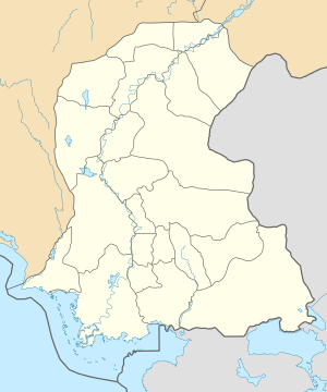
| Coordinates: 27°50′30″N 68°06′50″E / 27.84167°N 68.11389°ECoordinates: 27°50′30″N 68°06′50″E / 27.84167°N 68.11389°E | |
| Country |
|
| Region | Sindh |
| District | Qambar Shahdadkot District |
| Taluka | Sijawal Junejo |
| Union councils | 6 |
| Taluka Created | 1876/2004 |
| Government | |
| • Type | Local Government |
| • Taluka Nazim (2005-2009) | Mir Manzoor Ahmed Magsi |
| Population | |
| • Total | 117,459 |
| Time zone | UTC+5 (PST) |
| Area code(s) | 074 |
Sijawal Junejo (Sindhi: سجاول جونیجو) is a taluka of Qambar Shahdadkot District, division Larkana, Province of Sindh,Pakistan. It was established in 2004 when district Qambar Shahdadkot District was newly established. Sijawal Old Name was Sujawal Taluka.[1] At the time of British Government Sujawal was taluka from approximately 1876[2] to 1915 A.D. Later on Sujawal name was changed to Sijawal Junejo in 2000 A.D. Name was suggested by U.C Nazim of that time.
Sijawal Junejo is situated on main Motorway Ratodero- Gwadar Road. It is situated in the center of Ratodero Taluka and shahdadkot. Sijawal Junejo City is 19 km away from Shahdadkot City and 18 km away from Ratodero City. The city is connected by road directly Shahdadkot Ratodero, Mirokhan, Qamber and Larkana District Cities.
Many people from different caste backgrounds live in the city including, Magsi, Bhatti, Syed, Junejo, Gadhi, Soomro, and Lohar. There are many villages in its surroundings, such as Soharo Bhatti, Sir Shahnawaz Bhutto, Tharri.
Sijawal Junejo taluka has six Union Councils:
- UC: Sijawal Junejo
- UC: Arzi Bhutto
- UC: Dingano Mahesar
- UC: Haider Chandio
- UC: Mastoi
- UC: Thoof Chousool
History
The taluka was upgraded from UC to taluka in December 2004 and Split From Mirokhan taluka before upgradation Sijawal was UC of Mirokhan taluka. According to census 2017 total population of talka is 117,459.[3]
Political history General Election
Sijawal Junejo is home town of Pakistan Peoples Party. Former Prime Minister of Pakistan Zulfiqar Ali Bhutto and Benazir Bhutto were elected from Sijawal NA.207.
From Sijawal Junejo 1 M.N.A and 2 M.P.A's are elected:
Elected candidate (2002-2007)
NA 207: Shahid Hussain Bhutto (PPPP)[4]
PS 38: Haji Munawar Ali Abbasi (PPPP)[4]
PS 40: Sultan Ahmed Khuhawar (Independent)[4]
Elected candidate (2008-2013)
NA 207: Madam Faryal Talpur (PPPP)[5]
PS 38: Haji Munawar Ali Abbasi (PPPP)[5]
PS 40: Mir Nadir Ali Khan Magsi (PPPP)[5]
Elected candidate (2013-till)
Na 207: Madam Faryal Talpur (PPPP[6])
PS 38: Khurshed Ahmed Junejo (PPPP)[6]
PS 40: Mir Nadir Ali Khan Magsi (PPPP)[6]
Political History Local Government
UC Nazim (2000-2004): Mir Manzoor Ahmed Magsi (PPPP)
Taluka Nazim(2005-2009): Mir Manzoor Ahmed Magsi(PPPP)[7][8]
UC Nazim (2005-2009): Syed Deedar Ali Shah (PML-Q)
UC Chairman (2015-till): Raja Khan Bhatti (PPPP)[9]
District Council Member (2015-till): Mir Manzoor Ahmed Magsi[10][9]
Geography
Sijawal Junejo shares its borders with three talukas Ratodero, Mirokhan, Shahdadkot. Sijawal Junejo is situated at Latitude 27'50'30 (2750'30"N) and Longitude 68,06'50 (686'50.000"E). It is situated in North-western Sindh. Sijawal Weather is hot in Summer.[11]
Education
Sijawal Junejo city has Government and private schools. In Sijawal city Education is available til High School.
Health
Government Health Center is available at Sijawal City.
Economy
Sijawal Junejo is surrounded by a fertile land, where mainly rice and wheat, including Watermelon, Potatoes, etc. are also cultivated.
Demographics
The majority of the population of both the town and & the taluka of Sijawal Junejo speak the native Sindhi language. Urdu and English are also widely spoken and understood. Saraiki, Balochi, Punjabi and Brahui are also spoken in the city.
Transport
Sijawal Junejo is connected via vans run most towns in the surroundings, including Larkana, Shahdadkot, Ratodero, Mirokhan and Qambar. Passenger buses run between Sijawal Junejo and Karachi, Hyderabad, Sukkur.
See also
References
- ↑ "Historical maps of sindh 1600-1843 AD". panhwar.com. Retrieved 2018-04-05.
- ↑ "The Profile of District Kamber Shahdadkot Sindh Pakistan 2012 | Sindh | Nature". Scribd. Retrieved 2018-04-02.
- ↑ "Census Report of Pakistan" (PDF).
- 1 2 3 "ECP - Election Commission of Pakistan". www.ecp.gov.pk. Retrieved 2018-01-29.
- 1 2 3 "ECP - Election Commission of Pakistan". www.ecp.gov.pk. Retrieved 2018-01-29.
- 1 2 3 "ECP - Election Commission of Pakistan". www.ecp.gov.pk. Retrieved 2018-01-29.
- ↑ "Local Body Election in Qambar Shahdadkot Sindh 2015 Results Live Online - Baldiyati Intikhabat Schedule of Qambar Shahdadkot". hamariweb.com. Retrieved 2018-01-28.
- ↑ "Setback for PPP-backed candidates in Larkana". DAWN.COM. 2005-10-07. Retrieved 2018-01-28.
- 1 2 "ECP - Election Commission of Pakistan". www.ecp.gov.pk. Retrieved 2018-01-29.
- ↑ MASK. "District Council Qambar Shahdadkot UC Result Elections 2015". www.electionpakistani.com. Retrieved 2018-01-28.
- ↑ Newspaper, From the (2013-05-19). "Larkana remains hottest place in country". DAWN.COM. Retrieved 2018-01-28.