Sierra de Cazorla
| Sierra de Cazorla | |
|---|---|
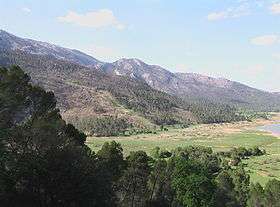 Landscape in Sierra de Cazorla | |
| Highest point | |
| Peak | Gilillo |
| Elevation | 1,847 m (6,060 ft) |
| Coordinates | 37°56′12″N 02°57′30″W / 37.93667°N 2.95833°WCoordinates: 37°56′12″N 02°57′30″W / 37.93667°N 2.95833°W |
| Geography | |
 Sierra de Cazorla | |
| Country | Spain |
| Parent range | Prebaetic System |
| Geology | |
| Mountain type | Limestone |
| Climbing | |
| Easiest route | From Cazorla |
Sierra de Cazorla is a mountain range of the Prebaetic System in the Jaén Province in Spain. It is named after the town of Cazorla. Its highest point is the 1,847 m high Gilillo peak.
Geography
This mountain range is located between the Sierra Nevada, the Sierra de Segura and Sierra del Pozo mountain ranges.[1] The easiest route to reach it is from Cazorla town.
The Santuario de la Virgen de Tíscar is a shrine dedicated to the Virgin Mary located on a mountain pass in Sierra de Cazorla.[2]
See also
- Baetic System
- Las Villas
- Sierra de Cazorla Comarca
- Sierras de Cazorla, Segura y Las Villas Natural Park
References
External links

- Asociación para el Desarollo Rural de la Sierra de Cazorla
- Parque Natural Sierras de Cazorla, Segura y Las Villas - official website
- Parque Natural Sierras de Cazorla, Segura y Las Villas
- Turismo Activo en el Parque Natural de las Sierras de Cazorla, Segura y Las Villas
This article is issued from
Wikipedia.
The text is licensed under Creative Commons - Attribution - Sharealike.
Additional terms may apply for the media files.